
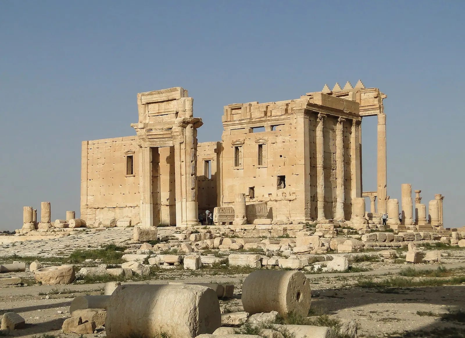
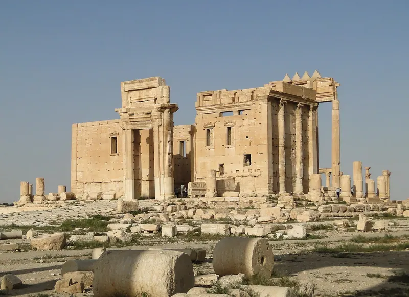
Temple of Bel, Palmyra, Syria · Photo: Bernard Gagnon · CC BY-SA 3.0 · Wikimedia Commons · Recorded 2010
Temple of Bel
Local name: معبد بل
The Temple of Bel was the principal sanctuary of Palmyra, consecrated to the god Bel, who was worshipped there together with the moon god Aglibol and the sun god Yarhibol. It stood at the eastern end of the Great Colonnade and is part of the World Heritage property Site of Palmyra. IS blew up the temple building in August 2015.
History
The temple rises on a tell occupied since the third millennium BC, above an earlier Hellenistic temple. The English and Arabic Wikipedias date its dedication to AD 32, the Arabic article citing a statue-base inscription of 6 Nisan in the Seleucid year 343; the German Wikipedia gives 32 BC instead. The porticoes of the court were built between about 80 and 120, the western portico only around the mid-second century. Aurelian's troops pillaged the temple in 273, and the emperor then had it repaired.[1][2][3][4]
Architecture
A wall about 205 m long enclosed a paved court lined with Corinthian porticoes, entered through the west gate. On a podium in the middle stood the cella, surrounded by columns. Unusually for a Roman-type temple, its entrance lay on a long side; inside were two shrines, north and south, as well as windows and stairs to roof terraces.[1][2]
Use and significance
The temple was closed between 385 and 388 under the praetorian prefect Maternus Cynegius and became a church in the Byzantine period. Under the Umayyads part of it served as a congregational mosque; from 1132 the precinct was a citadel enclosing the village of Tadmur. The mosque and houses remained in use until Franco-Syrian archaeologists cleared the precinct in the 1920s (the Arabic Wikipedia gives 1930).[1][3][4]
Notable features
The ceiling of the northern shrine showed a deity amid the seven planets and the twelve signs of the zodiac. A relief with a camel carrying the god's image and veiled women documents the festival processions. UNESCO counts the temple among the most important religious buildings of the first century AD in the East.[1][3][5]
Timeline
- 32
Dedication of the temple (AD 32 per the English and Arabic Wikipedias; 32 BC per the German Wikipedia).[1][2][3]
- c. 80–120
- 273
Pillaged by Aurelian's troops, then repaired.[4]
- 385–388
Closed during Maternus Cynegius' campaign against the temples of the East.[1]
- 1132
- 1929
Henri Seyrig begins excavating Palmyra with the Temple of Bel.[4]
- 2015
Blown up by IS (30 August), confirmed by satellite imagery (31 August).[1][2]
Gallery
3D documentation
Loaded from Sketchfab only after you click. Data is then sent to Sketchfab.
The 3D player could not be loaded here.
View 3D model on SketchfabLoading …
Temple of Bel
Shows the state after destruction or damage.
3D: Iconem · Captured 2016 · Licence: no free licence stated (embedded only) · Open on Sketchfab
Drag to rotate, scroll or pinch to zoom, full screen in the player.
Documented condition
Heavily damaged · as of 2017
IS blew up the temple building on 30 August 2015; on 31 August UNITAR confirmed from satellite imagery the destruction of the main building and an adjacent row of columns. The entrance arch and the outer walls survived. In July 2017 the French company Art Graphique et Patrimoine scanned the rubble as a basis for restoration planning.[1][2]
Visiting
Getting here
Documented ride, stay and transport services in Homs:
Nearby medical services
Straight-line distance from this place. Data: OpenStreetMap, as of 2026-10-30. Operating status not verified – call before going.
- مشفى تدمر الوطنيHospital · 2.2 kmDirections
Sources (22)
- Wikipedia (en): Temple of Bel rev. 1380328200 · CC BY-SA 4.0 · 2026-10-30
- Wikipedia (de): Baaltempel von Palmyra rev. 270791519 · CC BY-SA 4.0 · 2026-10-30
- Wikipedia (ar): معبد بل rev. 70779717 · CC BY-SA 4.0 · 2026-10-30
- Wikipedia (en): Palmyra rev. 1382053636 · CC BY-SA 4.0 · 2026-10-30
- UNESCO World Heritage Centre: Site of Palmyra · 2026-10-30
- Wikidata · CC0 · 2026-10-30
- Wikipedia (el) · CC BY-SA 4.0 · 2026-10-30
- Wikipedia (es) · CC BY-SA 4.0 · 2026-10-30
- Wikipedia (fa) · CC BY-SA 4.0 · 2026-10-30
- Wikipedia (fr) · CC BY-SA 4.0 · 2026-10-30
- Wikipedia (hi) · CC BY-SA 4.0 · 2026-10-30
- Wikipedia (id) · CC BY-SA 4.0 · 2026-10-30
- Wikipedia (it) · CC BY-SA 4.0 · 2026-10-30
- Wikipedia (ja) · CC BY-SA 4.0 · 2026-10-30
- Wikipedia (ko) · CC BY-SA 4.0 · 2026-10-30
- Wikipedia (nl) · CC BY-SA 4.0 · 2026-10-30
- Wikipedia (pl) · CC BY-SA 4.0 · 2026-10-30
- Wikipedia (pt) · CC BY-SA 4.0 · 2026-10-30
- Wikipedia (ru) · CC BY-SA 4.0 · 2026-10-30
- Wikipedia (sv) · CC BY-SA 4.0 · 2026-10-30
- Wikipedia (zh) · CC BY-SA 4.0 · 2026-10-30
- OpenStreetMap · ODbL · 2026-10-30
Verknüpft mit Q5747 (Palmyra); UNESCO-Zuordnung als Bestandteil der Welterbestätte 23 über Wikidata P361. Widersprüche: (1) Weihedatum 32 n. Chr. (en, ar, mit Inschrift 6. Nisan 343 seleukidisch) gegen 32 v. Chr. (de). (2) Umwandlung in eine Moschee: en-Palmyra nennt die Umayyaden (Teil des Tempels als Freitagsmoschee), en-Temple of Bel datiert Umbau und Moschee auf 1132, ar-Wikipedia schreibt Festungsbau Saladin im 12. Jh. zu; en-Palmyra nennt für 1132 die Buriden. (3) Nutzungsende als Moschee/Wohnort: 1920er-Jahre (en) bzw. 1930 (ar). (4) Maße: Mauerlänge 205 m bzw. Hof ca. 200 × 200 m (en), 210 × 205 m (ar); Mauerhöhe 11 m (de) bzw. ca. 14 m (ar) – Maße bis auf 205 m nicht übernommen. (5) Lage: de-Wikipedia „im Süden der antiken römischen Stadt“, en „am Ostende der Säulenstraße“. (6) Sprengdatum: AP-Bericht und de/ar 30. August 2015, UN-Bestätigung 31. August 2015. Der Text zum byzantinischen Fresko (Gabriel, Michael, Georg) steht nur in der ar-Wikipedia und wurde nicht übernommen.