
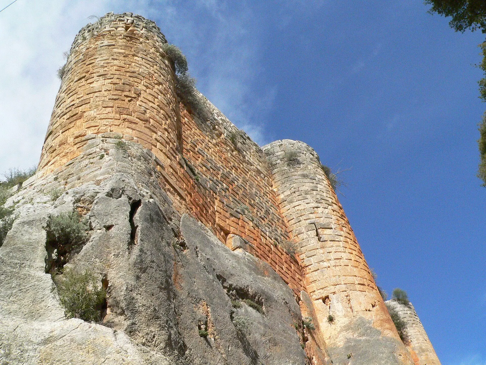
Saladin Castle – M. Disdero, 23 February 2005 · Photo: No machine-readable author provided. Disdero assumed (based on copyright claims). · CC BY 2.5 · Wikimedia Commons · Recorded 2005
Citadel of Salah Ed-Din
Local name: قلعة صلاح الدين الأيوبي
The Citadel of Salah Ed-Din, also known as Saladin's Castle, Sahyun or Saône, stands on the western slopes of the coastal mountains about 30 kilometres east of Latakia, near al-Haffah. Built on a ridge between two deep ravines, it combines Byzantine, Frankish and Ayyubid–Mamluk building phases. Since 2006 it has been a World Heritage Site together with Krak des Chevaliers, and since 2013 the property has been on the List of World Heritage in Danger.
History
The site has been fortified since at least the mid-10th century; its first known holder, according to English Wikipedia, was a dependent of the Hamdanid emir Sayf al-Dawla. In 975 the Byzantine emperor John I Tzimiskes captured it, and the Byzantines expanded the fortifications. Around 1108 it passed to the Crusader Principality of Antioch; German Wikipedia names Tancred. Robert (called “the Leper” in English Wikipedia) held it from at least 1119; German Wikipedia says he was captured and executed that same year, and that his son William built the castle on a grand scale. Unusually, it was never entrusted to a military order.
In July 1188 Saladin and his son az-Zahir Ghazi besieged the castle; the day-by-day dates differ (English Wikipedia: arrival 27 July, assault 29 July; German Wikipedia: arrival 24 July, breach 26 July). After two to three days of bombardment the attackers broke in and the garrison surrendered on payment of ransom. Saladin granted the castle to the emir Nasir al-Din Mankawar, whose heirs held it until 1272, when it passed to Sultan Baibars. The dissident emir Sunqur al-Ashqar made it the centre of a semi-independent emirate in the 1280s (German Wikipedia: 1280) until he surrendered it to Sultan Qalawun in 1287. It remained significant under the Mamluks until at least the late 14th century but was later abandoned.[1][2][3]
Architecture
The castle occupies a ridge some 700 metres long (Arabic Wikipedia: 740 m), originally joined to a plateau on the east. There a ditch 28 metres deep was cut into the rock, leaving a needle of rock to support the bridge; English Wikipedia gives its length and width as 156 m and 14–20 m, German Wikipedia as 130 m and 20 m. A keep with walls about 5 metres thick, built partly of rusticated blocks up to four metres long, overlooks the ditch.
At the centre lies the Byzantine citadel; there are also cisterns, a Crusader church next to one of two Byzantine chapels, a mosque from Qalawun's reign and an Ayyubid palace with a bath, courtyards and iwans. According to UNESCO, the palace's main gate was reconstructed in 1936; the emphasis today is on consolidation and conservation.[1][2][3][4]
Historical use and significance
The castle guarded the route from Latakia to the Orontes valley and on to Aleppo and Antioch. UNESCO notes that, though partly in ruins, it retains features from its Byzantine beginnings in the 10th century, the Frankish transformations and the Ayyubid fortifications, documenting the exchange of defensive technology in the Near East. In the early 20th century T. E. Lawrence called it “the most sensational thing in castle building I have ever seen.”[1][2][4]
Timeline
Gallery
3D documentation
Loaded from Sketchfab only after you click. Data is then sent to Sketchfab.
The 3D player could not be loaded here.
View 3D model on SketchfabLoading …
Citadel of Salah Ed-Din
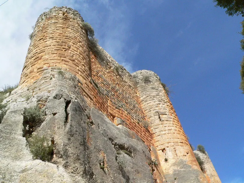
3D: Iconem · Captured 2016 · Licence: CC BY-NC 4.0 · Open on Sketchfab
Drag to rotate, scroll or pinch to zoom, full screen in the player.
Documented condition
Partly damaged · as of 2023
According to English Wikipedia, the castle had survived the civil war without significant damage as of 2016. In the February 2023 earthquake one of its fortified towers was destroyed. The World Heritage property has been on the danger list since 2013.[1][4]
Visiting
Getting here
Documented ride, stay and transport services in Latakia:
Nearby medical services
Straight-line distance from this place. Data: OpenStreetMap, as of 2026-10-30. Operating status not verified – call before going.
- HospitalHospital · 1.3 kmDirections
- National Hospital in QardahaHospital · 14 kmDirections
- مستوصف عين اللبنHospital · 15 kmDirections
- HospitalHospital · 19 kmDirections
- مستوصف الشهيد نوار غسان يوسفHospital · 24 kmDirections
- مشفى العثمان الجراحيHospital · 24 kmDirections
Sources (23)
- Wikipedia (en): Sahyun Castle rev. 1365036534 · CC BY-SA 4.0 · 2026-10-30
- Wikipedia (de): Qalʿat Salah ed-Din rev. 259652904 · CC BY-SA 4.0 · 2026-10-30
- Wikipedia (ar): قلعة صلاح الدين الأيوبي (سوريا) rev. 69858899 · CC BY-SA 4.0 · 2026-10-30
- UNESCO World Heritage Centre: Crac des Chevaliers and Qal'at Salah El-Din · 2026-10-30
- Wikidata · CC0 · 2026-10-30
- Wikipedia (el) · CC BY-SA 4.0 · 2026-10-30
- Wikipedia (es) · CC BY-SA 4.0 · 2026-10-30
- Wikipedia (fa) · CC BY-SA 4.0 · 2026-10-30
- Wikipedia (fr) · CC BY-SA 4.0 · 2026-10-30
- Wikipedia (hi) · CC BY-SA 4.0 · 2026-10-30
- Wikipedia (id) · CC BY-SA 4.0 · 2026-10-30
- Wikipedia (it) · CC BY-SA 4.0 · 2026-10-30
- Wikipedia (ja) · CC BY-SA 4.0 · 2026-10-30
- Wikipedia (ko) · CC BY-SA 4.0 · 2026-10-30
- Wikipedia (nl) · CC BY-SA 4.0 · 2026-10-30
- Wikipedia (pl) · CC BY-SA 4.0 · 2026-10-30
- Wikipedia (pt) · CC BY-SA 4.0 · 2026-10-30
- Wikipedia (ru) · CC BY-SA 4.0 · 2026-10-30
- Wikipedia (sv) · CC BY-SA 4.0 · 2026-10-30
- Wikipedia (tr) · CC BY-SA 4.0 · 2026-10-30
- Wikipedia (ur) · CC BY-SA 4.0 · 2026-10-30
- Wikipedia (zh) · CC BY-SA 4.0 · 2026-10-30
- OpenStreetMap · ODbL · 2026-10-30
Relation über Wikidata P361 Q15604681 und P757 1229-002; Label nach UNESCO-Eintrag 1229. Konflikte: Belagerungsdaten 1188 (en: 27./29. Juli; de: 24.–26. Juli; ar: 26.–29. Juli); Graben 156 m × 14–20 m (en) vs. 130 m × 20 m (de), Tiefe übereinstimmend 28 m; Gratlänge 700 m (en) vs. 740 m (ar); Entfernung zu Latakia 30 km östlich (en-Einleitung, de) vs. ca. 25 km nordöstlich (en-Text); Sunqur al-Aschqar ab 1280 (de) vs. „in den 1280ern“ (en); Restaurierung des Palasttors 1936 (UNESCO) vs. 1937 (ar). en-Angabe „Donjon ca. 24 m²“ offensichtlich fehlerhaft, nicht übernommen. ar-Herleitung des Namens von Arwad/„Sifon“ nicht übernommen. UNESCO-Zustandsberichte (SOC) nicht im Paket.