
Photo: Dosseman · CC BY-SA 4.0 · Wikimedia Commons · Recorded 2010
Arwad Castle
Local name: قلعة أرواد
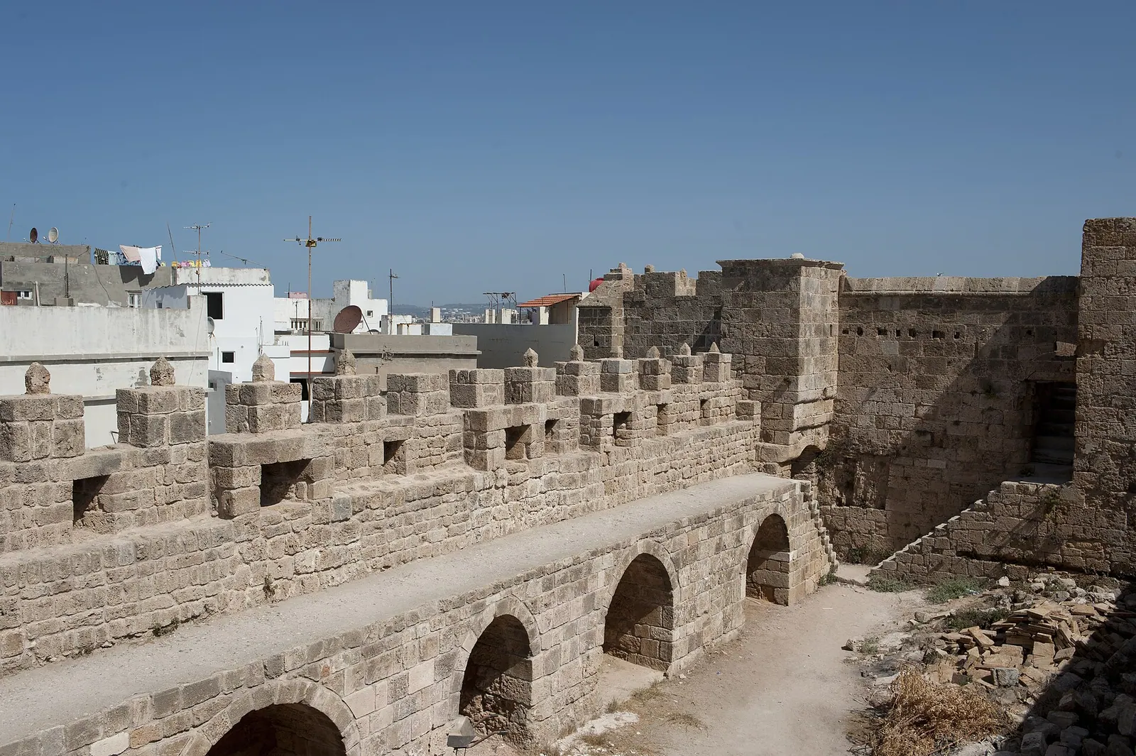
Arwad Castle is the large fortress at the centre of the island of Arwad off Tartus, Syria's only inhabited island. According to the UNESCO description, the rectangular building with its courtyard and wall-walk is Ayyubid in style, with Crusader and Ottoman alterations. Under the French Mandate it served as a prison, and after 1946 as a local museum.
History
The island itself has been inhabited since the 2nd millennium BC or earlier; the fortress is much later. According to the Arabic Wikipedia it was built on the remains of Canaanite structures, taken by the Arabs in 640, and fortified with walls and defences by the Templars during the Crusades. The UNESCO Tentative List description suggests the central fortress took over the site of an older building and assigns it on stylistic grounds to the Ayyubid period (12th century), with Crusader changes in the 13th and Ottoman changes in the 15th century.
After the loss of the mainland in 1291 the island was the Crusaders' last foothold; in 1302 the Templars kept a garrison there. In September 1302 (26 September according to the English Wikipedia) they surrendered to the Mamluks after a siege. The Arabic Wikipedia article on the castle attributes the capture to Sultan Qalawun, whereas UNESCO links Qalawun to the defeat of Tartus in 1291.
The French navy occupied the island in 1915. Under the Mandate the French used the fortress as a prison for opponents of their rule; according to the English Wikipedia the captives' graffiti are still visible. The German Wikipedia states that the politician Faris al-Khuri was held here for 76 days after the outbreak of the 1925 revolt. After independence in 1946 the fortress became a local museum.[1][2][3][5]
Architecture
The central fortress is larger than the small fort by the harbour and rests directly on the bedrock. It is rectangular; parts of its walls contain large blocks resembling the island's so-called Phoenician ramparts or possibly taken from an older building. Halls presumed to be Ottoman surround the central courtyard, topped by a wall-walk with crenellated walls. According to the Arabic Wikipedia the Lusignan coat of arms is carved on its gate; the Arabic article on the island instead places this emblem on the coastal fort ("al-Burj" or the "Ayyubid tower").[1][4][5]
Use and significance
The fortress served as a defensive work, in the 20th century as a prison and afterwards as a museum. According to the German Wikipedia the fortress building today forms the centre of the island village. UNESCO's Tentative List entry for Arwad names the two medieval forts, together with the wall remains, the harbour and the dense urban fabric, as surviving evidence of the island's history.[1][3][5]
Timeline
- 640
Taken by the Arabs (according to the Arabic Wikipedia).[1]
- 12th c.
Central fortress dated stylistically to the Ayyubid period (UNESCO).[5]
- Sep 1302
Templars on the island surrender to the Mamluks.[1][2][3][5]
- 1915
- 1925
Faris al-Khuri imprisoned in the fortress.[3]
- after 1946
Converted into a local museum.[1]
Gallery
Documented condition
Preserved · as of 2026
The German Wikipedia (October 2026) describes the old fortress building as well preserved. The English Wikipedia reports that there was no fighting on the island during the civil war.[2][3]
Visiting
Getting here
Documented ride, stay and transport services in Tartus:
Nearby medical services
Straight-line distance from this place. Data: OpenStreetMap, as of 2026-10-30. Operating status not verified – call before going.
- مركز الكورنيش الاسعافيHospital · 3.3 kmDirections
- Al Hekma HospitalHospital · 3.9 kmDirections
- Dr. Youssef Al Hussein Fertility CenterHospital · 4 kmCallDirections
- مستشفى الرازيHospital · 4.1 kmDirections
- Syrian IVF CentreHospital · 4.1 kmDirections
- PascualHospital · 4.1 kmCallDirections
Sources (7)
- Wikipedia (ar): قلعة أرواد rev. 75996907 · CC BY-SA 4.0 · 2026-10-30
- Wikipedia (en): Arwad rev. 1374752573 · CC BY-SA 4.0 · 2026-10-30
- Wikipedia (de): Aruad rev. 271740420 · CC BY-SA 4.0 · 2026-10-30
- Wikipedia (ar): أرواد rev. 76009570 · CC BY-SA 4.0 · 2026-10-30
- UNESCO World Heritage Centre, Tentative List: Arwad (ref. 1303) · 2026-10-30
- Wikidata · CC0 · 2026-10-30
- OpenStreetMap · ODbL · 2026-10-30
Insel (Q377802) und Festung bewusst getrennt; Inselgeschichte nur als Kontext. Kein deutsches Label und keine deutsche Einzelseite: deutscher Name nach der Formulierung der de-Wikipedia zur Insel („Festung im Zentrum der Insel“) gebildet – redaktionell prüfen. Datierung: kanaanäische Grundlage (ar) vs. stilistisch ayyubidisch, 12. Jh. (UNESCO). Einnahme 1302: ar-Festungsartikel nennt Qalawun, UNESCO verbindet Qalawun mit Tartus 1291, en/de nennen nur „die Mamluken“. Lusignan-Wappen: am Festungstor (ar Festung) vs. am Küstenfort (ar Insel). Ayyubidischer Turm: laut de (nach Satık) in der zentralen Festung, laut ar-Inselartikel identisch mit dem Küstenfort – offen. Ob die Templer-Ereignisse 1300–1302 die Festung selbst betrafen, sagen en/de nicht ausdrücklich. Zustand nur aus der de-Wikipedia; Museumsbetrieb heute nicht belegt. Datum der Aufnahme in die UNESCO-Vorschlagsliste nicht im Paket.