
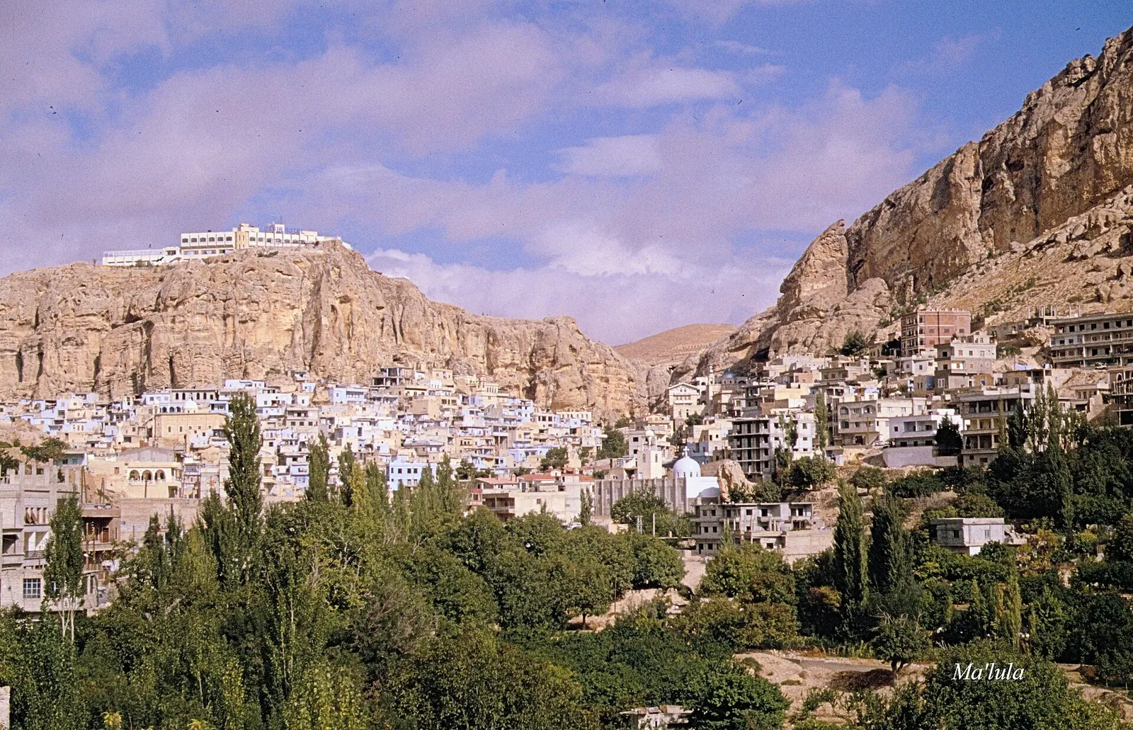
Maaloula · Photo: Haubi|Gerhard Haubold · CC BY-SA 4.0 · Wikimedia Commons · Recorded 1994
Qalamoun Mountains
Local name: جبال القلمون
According to English Wikipedia, the Qalamoun Mountains (Arabic Jibal al-Qalamoun) are the north-eastern portion of the Anti-Lebanon Mountains, north-east of Damascus. The region is known for its mountain towns, Christian sanctuaries and orchards, and Aramaic is still spoken in some of its towns.
Landscape
English Wikipedia describes the range as running from the Barada River valley in the south-west to the city of Hisyah in the north-east. Arabic Wikipedia describes it as a mountain chain in western Syria extending from al-Duraij in the south to al-Burayj in the north, lying north-west of Damascus and also called the Anti-Lebanon range.
According to Arabic Wikipedia, summers are mild to cool, while winters bring heavy snowfall that covers towns and peaks. Dozens of natural and mineral springs occur along the range.[1][2]
History
Arabic Wikipedia notes numerous antiquities, caves, rock-cut buildings, temples and historically important monasteries, churches and Christian shrines among the mountains. According to English Wikipedia, the Cherubim Monastery at Saidnaya stands on the peak of the range. English Wikipedia also refers to fighting during the civil war in 2013, 2014, 2015 and 2017 and to the evacuation of rebels from eastern Qalamoun.[1][2]
Significance
Arabic Wikipedia lists towns including Zabadani, Wadi Barada, Yabroud, al-Tall, Saidnaya, Maarat Saidnaya, Ain Minin, Maaloula, Rankous, Talfita, Bakhaa, Jubb'adin, al-Nabk, Qara, Deir Atiyah and Assal al-Ward. For the eastern part, English Wikipedia names al-Qutayfah, al-Naseriyah, al-Ruhaybah, Jayrud, Muadamiyat al-Qalamoun and al-Dumayr.
According to Arabic Wikipedia, the inhabitants are known for trade, and in several towns Aramaic (Syriac) is still spoken in daily life. Fruit growing is widespread, notably cherries, apricots, peaches, pears, apples, figs and grapes.[1][2]
Gallery
Documented condition
Current condition not documented
Visiting
Getting here
Documented ride, stay and transport services in Rif Dimashq:
Nearby medical services
Straight-line distance from this place. Data: OpenStreetMap, as of 2026-10-30. Operating status not verified – call before going.
- Qalamoon HospitalHospital · 10 kmDirections
- المعهد التقاني الطبيHospital · 10 kmDirections
- Deir Atiya's national HospitalHospital · 11 kmDirections
- HospitalHospital · 15 kmDirections
- مشفى يبرودHospital · 16 kmDirections
Sources (8)
- Wikipedia (en): Qalamoun Mountains rev. 1264086988 · CC BY-SA 4.0 · 2026-10-30
- Wikipedia (ar): جبال القلمون rev. 73616947 · CC BY-SA 4.0 · 2026-10-30
- Wikidata · CC0 · 2026-10-30
- Wikipedia (es) · CC BY-SA 4.0 · 2026-10-30
- Wikipedia (fr) · CC BY-SA 4.0 · 2026-10-30
- Wikipedia (ru) · CC BY-SA 4.0 · 2026-10-30
- Wikipedia (sv) · CC BY-SA 4.0 · 2026-10-30
- OpenStreetMap · ODbL · 2026-10-30
Widersprüchliche Abgrenzung: en „nordöstlicher Teil des Antilibanon, nordöstlich von Damaskus, vom Barada-Tal bis Hisya“; ar „nordwestlich von Damaskus, von ad-Duraidsch bis al-Buraidsch, auch Ostlibanon genannt“ (setzt Qalamun mit dem Antilibanon gleich). Wikidata führt zwei Koordinaten (34.0016, 36.8226 und 33.8, 36.4333). Die en-Ortsliste für das westliche Qalamun fehlt im Pack; Ortsnamen westlich aus ar. Kampfhandlungen 2013–2017 nur als Siehe-auch-Titel in en, ohne Details – keine Zeitleiste. Deutscher Name ist Übertragung (kein de-Artikel). Keine Höhenangaben in den Quellen.