
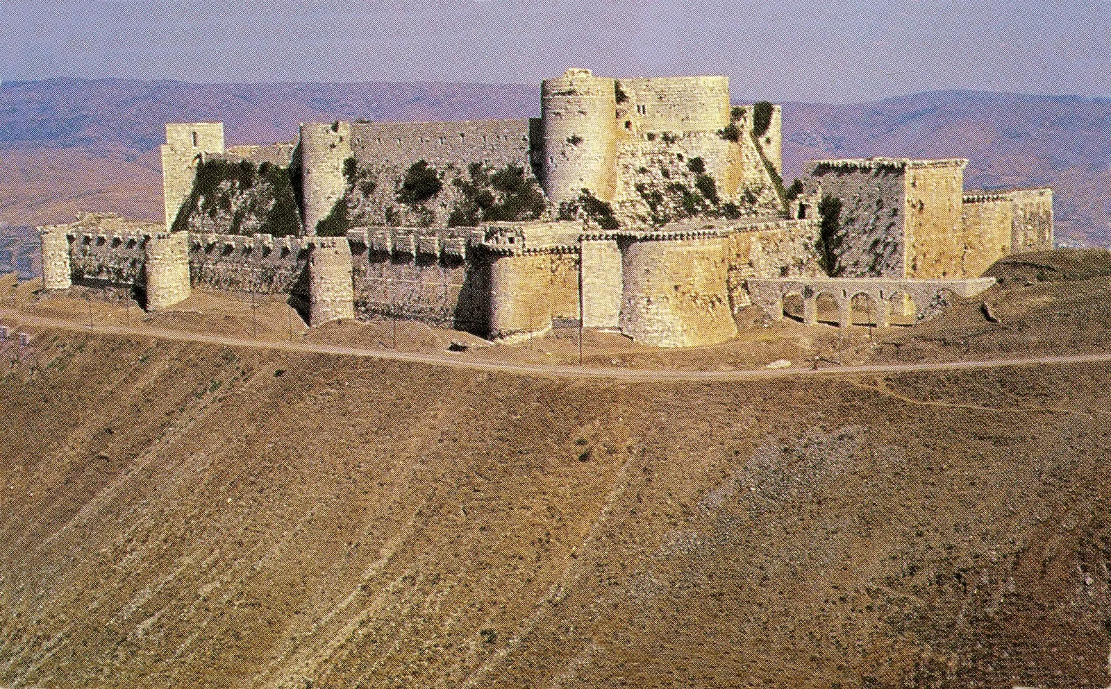
Qal'at al-Hosn from the west · Photo: Gerhard Haubold · CC BY-SA 4.0 · Wikimedia Commons · Recorded 1994
Krak des Chevaliers
Local name: قلعة الحصن
Krak des Chevaliers, in Arabic Qalʿat al-Hisn, is a castle on a hill about 650 m high in the Homs Gap, some 40 km west of Homs. The fortress visible today is largely the work of the Knights Hospitaller, who held it from 1142 to 1271, with later Mamluk additions. Together with Qal'at Salah El-Din it has formed a serial UNESCO World Heritage property since 2006.
History
According to the historian Ibn Shaddad, the Mirdasid emir of Aleppo and Homs settled Kurdish troops at the site in 1031, hence the name Hisn al-Akrad, “fortress of the Kurds”. In January 1099 the army of the First Crusade under Raymond of Toulouse encountered the fort and briefly occupied it; permanent Crusader control began in 1110 under Tancred. In 1142 Count Raymond II of Tripoli handed it to the Hospitallers.
The Hospitallers built a new castle until an earthquake struck in 1170; the German Wikipedia also records a quake in 1157. After another earthquake in 1201/02 came the 13th-century expansion that gave the castle its present form. In 1271 Sultan Baibars took it after undermining a tower; on 8 April the garrison surrendered, deceived by a forged letter from its Grand Master. The Mamluks repaired the damage, and in 1285 Qalawun added a square tower.
In the Ottoman period the castle housed a company of janissaries and was the centre of a tax district. In the late 19th century a village of about 500 people grew up inside it. On 16 November 1933 the castle passed into French control; the villagers were moved and compensated, and clearance and restoration followed under Pierre Coupel (1934–1936 according to the German Wikipedia). The English Wikipedia has Syria assume control at independence in 1946, while the German Wikipedia cites a treaty of 7 February 1949.[1][2]
Architecture
Krak is a spur castle that became a fully developed concentric castle after its 13th-century expansion. The inner castle of 1142–1170 had a curtain wall with slightly projecting square towers. In the 13th century its west and south sides received a steep glacis with large round towers, the south-western one housing the Grand Master. The hall of the Knights has Gothic tracery, probably of the 1230s.
The outer circuit, about 9 m high, has strongly projecting round towers and box machicolations that resemble work at the Citadel of Aleppo. From the north-east gate a vaulted bent entrance 137 m long, fitted with murder-holes, climbs to the inner ward.[1][2]
Use and significance
For the Hospitallers the castle was both a military base and the administrative centre of their holdings in the County of Tripoli. In the first half of the 13th century it held a garrison of about 2,000; from here the knights exacted tribute from Hama and Homs and mounted expeditions, for example against Hama in 1230 and 1233. In 1218 King Andrew II of Hungary called it the “key of the Christian lands”.
After 1271 the Hospitaller chapel was converted into a mosque with two mihrabs. According to the German Wikipedia the fortress remained in military use until the early 19th century; in 1894 the district seat was moved to Talkalakh. Under the French Mandate it became one of the main tourist sites of the Levant.[1][2]
Notable features
The castle is one of the few places where Crusader painting survives: wall paintings came to light in 1935, 1955 and 1978 as later plaster decayed, among them a Presentation of Jesus in the Temple on the outside of the chapel. UNESCO describes Krak as the best-preserved Crusader castle and an archetype of the medieval castle of the military orders.[1][2][3]
Timeline
- 1031
The Mirdasid emir settles a Kurdish garrison; the name Hisn al-Akrad.[1][2]
- 1142
Raymond II of Tripoli hands the castle to the Knights Hospitaller.[1][2][3]
- 1170
An earthquake damages the castle, ending the first building phase.[1][2]
- early 13th c.
Expansion into a concentric castle with an outer wall.[1][2]
- 1271
- 1933
Transfer to France, relocation of the inhabitants, followed by restoration.[1][2]
- 2006
UNESCO World Heritage together with Qal'at Salah El-Din.[3]
- 2012–2014
War damage from shelling and air strikes; recaptured by government forces in March 2014.[1][2]
Gallery
3D documentation
Loaded from Sketchfab only after you click. Data is then sent to Sketchfab.
The 3D player could not be loaded here.
View 3D model on SketchfabLoading …
Krak des Chevaliers
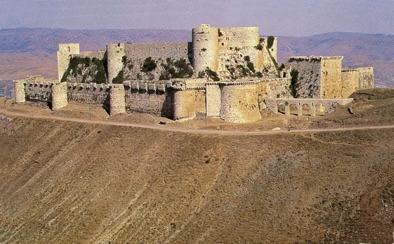
3D: Iconem · Captured 2016 · Licence: CC BY 4.0 · Open on Sketchfab
Drag to rotate, scroll or pinch to zoom, full screen in the player.
Documented condition
Under restoration · as of 2024
During the civil war the castle was occupied by rebels in 2011/12. In August 2012 shelling by the Syrian army damaged the chapel; further damage was caused by air strikes in July 2013 and on 18 August 2013. In March 2014 (on 20 March according to the German Wikipedia) government forces retook the castle and village. The property has been on the List of World Heritage in Danger since 2013.
Between 2016 and 2024 a Hungarian mission from Péter Pázmány University coordinated extensive restoration, including conservation of the chapel frescoes, reconstruction of the Baibars gate and repair of war damage and of damage from the 2023 earthquake.[1][2][3]
Visiting
Getting here
Documented ride, stay and transport services in Homs:
Nearby medical services
Straight-line distance from this place. Data: OpenStreetMap, as of 2026-10-30. Operating status not verified – call before going.
- Al Hosn hospitalHospital · 2.7 kmDirections
- مستشفى المزينة الخاصHospital · 3.9 kmCallDirections
- مستشفى تلكلخ الوطنيHospital · 11 kmDirections
- HospitalHospital · 18 kmDirections
- مشفى سبةHospital · 18 kmDirections
- مشفى سبةHospital · 18 kmDirections
Sources (21)
- Wikipedia (en): Krak des Chevaliers rev. 1370795669 · CC BY-SA 4.0 · 2026-10-30
- Wikipedia (de): Krak des Chevaliers rev. 270573480 · CC BY-SA 4.0 · 2026-10-30
- UNESCO World Heritage Centre: Crac des Chevaliers and Qal’at Salah El-Din · 2026-10-30
- Wikidata · CC0 · 2026-10-30
- Wikipedia (ar) · CC BY-SA 4.0 · 2026-10-30
- Wikipedia (el) · CC BY-SA 4.0 · 2026-10-30
- Wikipedia (es) · CC BY-SA 4.0 · 2026-10-30
- Wikipedia (fa) · CC BY-SA 4.0 · 2026-10-30
- Wikipedia (fr) · CC BY-SA 4.0 · 2026-10-30
- Wikipedia (id) · CC BY-SA 4.0 · 2026-10-30
- Wikipedia (it) · CC BY-SA 4.0 · 2026-10-30
- Wikipedia (ja) · CC BY-SA 4.0 · 2026-10-30
- Wikipedia (ko) · CC BY-SA 4.0 · 2026-10-30
- Wikipedia (nl) · CC BY-SA 4.0 · 2026-10-30
- Wikipedia (pl) · CC BY-SA 4.0 · 2026-10-30
- Wikipedia (pt) · CC BY-SA 4.0 · 2026-10-30
- Wikipedia (ru) · CC BY-SA 4.0 · 2026-10-30
- Wikipedia (sv) · CC BY-SA 4.0 · 2026-10-30
- Wikipedia (tr) · CC BY-SA 4.0 · 2026-10-30
- Wikipedia (zh) · CC BY-SA 4.0 · 2026-10-30
- OpenStreetMap · ODbL · 2026-10-30
Serielle Welterbestätte 1229 (Crac des Chevaliers und Qal'at Salah El-Din, 2006, Kriterien ii und iv, seit 2013 gefährdet); Qal'at Salah El-Din ist ein eigener Datensatz (Q277531). Widersprüche: (1) Besetzung 1099 – en: kurz im Februar 1099 besetzt, de: zehn Tage besetzt. (2) Erdbeben – en nennt 1170 (und 1202), de 1157 und 1170 (und 1201/02). (3) Übergabe an die Johanniter – en-Einleitung 1142, en-Text „zwischen 1142 und 1144“; UNESCO 1142. (4) Belagerung 1271 – en: Ankunft Baibars 3. März, Vorwerk 21. März, Bresche 29. März; de: Sultan ab 21. Februar, Vorwerk 22. März, Sturm auf den Zwinger 31. März; Kapitulation übereinstimmend 8. April – im Text nur die übereinstimmenden Angaben. (5) 1933 – en-Einleitung „an den französischen Alawitenstaat“, en-Text „unter Kontrolle des französischen Staates, betreut von der Académie des Beaux-Arts“, de „von Frankreich gekauft“. (6) Rückgabe an Syrien 1946 (en) gegen Vertrag vom 7. Februar 1949 (de). (7) Rückeroberung 2014: en „März 2014“, de „20. März 2014“. Der Restaurierungsabschnitt 2016–2024 beruht allein auf de-Wikipedia; Wikidata-Inception 1031 entspricht der ersten Befestigung, nicht dem heutigen Bau. Angaben zur Wiedereröffnung für Besucher (de, 2015) bewusst nicht übernommen.