
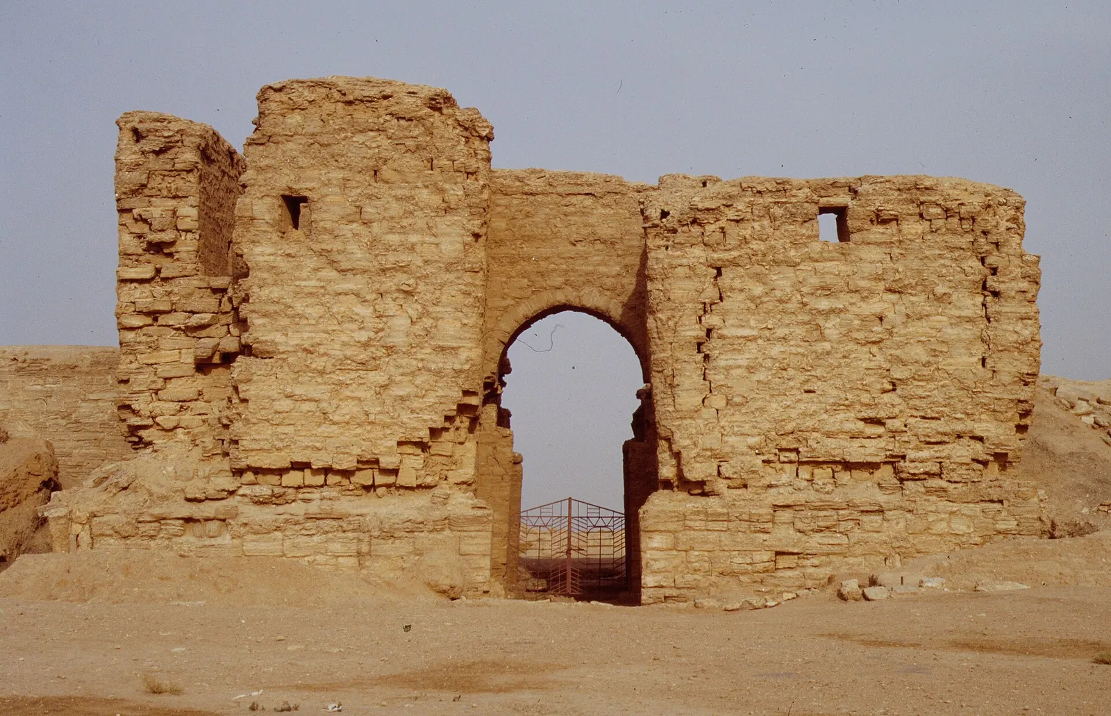
Dura Europos · Photo: Haubi|Gerhard Haubold · CC BY-SA 4.0 · Wikimedia Commons · Recorded 1994
Dura-Europos
Local name: دورا أوربوس
Dura-Europos was a Hellenistic, Parthian and Roman border city on an escarpment some 90 metres above the southwestern bank of the Euphrates, near the village of Salhiyé. Founded by the Seleucids around 300 BC, it was taken by the Sasanians in 256–257 AD and never built over again. Its temples, houses, wall paintings and written finds therefore survived exceptionally well, and it is often called the “Pompeii of the Desert”.
History
The city was founded around 300 BC under Seleucus I Nicator as a fortress where the Euphrates route met the road between Antioch and Seleucia on the Tigris. Greeks called it Europos after Seleucus's Macedonian birthplace, while “Dura” means “fortress” in Aramaic; the combined form “Dura-Europos” is modern, coined by Franz Cumont in 1922. A cuneiform tablet naming a place Da-wa-ra may point to an earlier settlement, though no buildings from that time are known. In the 2nd century BC the city was rebuilt on a Hippodamian grid.
The Parthians took Dura around 113 BC (German Wikipedia: c. 114 BC), and it became a regional administrative centre with a mixed population. After a brief occupation under Trajan, the Romans captured it decisively in 165 AD (Hopkins's timeline: 164) and made it their easternmost stronghold, with a military camp. Before the Sasanian attack the defenders filled the buildings along the western wall with earth. In 256–257 Shapur I took the city and deported its population; according to German Wikipedia it was probably finally abandoned in 273.[1][2][4]
Site
The city area is given as 45 hectares for the flat part (English Wikipedia), about 50 hectares (Arabic Wikipedia) and about 75 hectares (UNESCO); German Wikipedia states that roughly 40 per cent has been excavated. The wall with the Palmyrene Gate survives in elevation except for parts of the north and south ramparts. Buildings include numerous temples – among them those of Artemis, Bel, Atargatis, Zeus Theos and the Gadde – a Mithraeum, the Palace of the Strategos, the Roman principia, baths, shops and a necropolis with tomb towers.
The embankment along the western wall preserved in particular the synagogue, with its large cycle of figurative wall paintings (last phase dated 244), and the house church, considered the earliest known Christian church building. The synagogue is covered in a separate record.[1][2][3][4]
Historical use and significance
Inscriptions and papyri in Greek, Latin, Palmyrene, Hebrew, Hatran, Safaitic, Middle Persian and Parthian attest a multilingual society, and the archive of the Cohors XX Palmyrenorum documents the Roman army on the eastern frontier. The traces of the siege – mines, countermines and finds such as painted shields and complete sets of horse armour – are a unique record of ancient warfare. Excavation history: wall paintings uncovered by British troops in 1920, campaigns under Cumont, Yale and the Académie des inscriptions in 1928–1937, and from 1986 a Franco-Syrian mission under Pierre Leriche (Arabic Wikipedia: 1980), ended in 2011.
According to English Wikipedia, Dura-Europos was placed on the UNESCO Tentative List in 1999 and included again in 2011 together with Mari.[1][2][3][4][5]
Timeline
- c. 300 BC
- c. 113 BC
Taken by the Parthians (German Wikipedia: c. 114 BC).[1][2][4]
- 165
- 244
Last phase of the synagogue, dated by inscription.[1]
- 256–257
Siege and capture by Shapur I; the population is deported.[1][2][4]
- 30 March 1920
British soldiers uncover wall paintings in the Temple of Bel.[1][3]
- 1928–1937
Excavations by Yale University with the Académie des inscriptions et belles-lettres.[2][3]
- 2011–2014
Gallery
Documented condition
Heavily damaged · as of 2015
According to German Wikipedia, satellite images of 4 August 2011 and 2 April 2014 document systematic looting; by November 2013 the city area resembled a landscape of craters, and the site museum was reported by an ICOM task force as “completely looted”. English Wikipedia states that satellite imagery in 2015 showed more than 70 per cent of the site destroyed by looters, chiefly by the Islamic State.[1][2]
Visiting
Getting here
Documented ride, stay and transport services in Deir ez-Zor:
Nearby medical services
Straight-line distance from this place. Data: OpenStreetMap, as of 2026-10-30. Operating status not verified – call before going.
- مشفى هجين العامHospital · 10 kmDirections
- Subaykhan HospitalClinic / health centre · 16 kmDirections
Sources (23)
- Wikipedia (en): Dura-Europos rev. 1381351642 · CC BY-SA 4.0 · 2026-10-30
- Wikipedia (de): Dura Europos rev. 266959850 · CC BY-SA 4.0 · 2026-10-30
- Wikipedia (ar): دورا أوربوس rev. 76940528 · CC BY-SA 4.0 · 2026-10-30
- UNESCO World Heritage Centre, Tentative List: Dura Europos · 2026-10-30
- UNESCO World Heritage Centre, Tentative List: Mari and Europos-Dura · 2026-10-30
- Wikidata · CC0 · 2026-10-30
- Wikipedia (el) · CC BY-SA 4.0 · 2026-10-30
- Wikipedia (es) · CC BY-SA 4.0 · 2026-10-30
- Wikipedia (fa) · CC BY-SA 4.0 · 2026-10-30
- Wikipedia (fr) · CC BY-SA 4.0 · 2026-10-30
- Wikipedia (id) · CC BY-SA 4.0 · 2026-10-30
- Wikipedia (it) · CC BY-SA 4.0 · 2026-10-30
- Wikipedia (ja) · CC BY-SA 4.0 · 2026-10-30
- Wikipedia (ko) · CC BY-SA 4.0 · 2026-10-30
- Wikipedia (nl) · CC BY-SA 4.0 · 2026-10-30
- Wikipedia (pl) · CC BY-SA 4.0 · 2026-10-30
- Wikipedia (pt) · CC BY-SA 4.0 · 2026-10-30
- Wikipedia (ru) · CC BY-SA 4.0 · 2026-10-30
- Wikipedia (sv) · CC BY-SA 4.0 · 2026-10-30
- Wikipedia (ur) · CC BY-SA 4.0 · 2026-10-30
- Wikipedia (zh) · CC BY-SA 4.0 · 2026-10-30
- UNESCO World Heritage Centre · © UNESCO (link only) · 2026-10-30
- OpenStreetMap · ODbL · 2026-10-30
Relation hasPart Q1577089 (Synagoge) durch Wikidata P527 gestützt; eigener Eintrag für die Synagoge existiert. Konflikte: Parthische Eroberung 113 v. Chr. (en, UNESCO) vs. um 114 v. Chr. (de); Trajan 114 n. Chr. (en-Einleitung) vs. 116 (Zeittafel nach Hopkins in en); römische Eroberung 165 (en, ar, UNESCO) vs. 164 (Hopkins); endgültige Aufgabe wohl 273 (de) vs. Debatte über sporadische Nutzung bis ins 5. Jh. (en); Flächenangaben 45 ha (en, nur ebener Teil) / ca. 50 ha (ar) / ca. 75 ha (UNESCO); Beginn der französisch-syrischen Mission 1986 (en, de) vs. 1980 (ar); erste Grabung 1920 (en, ar) vs. 1921 unter Captain Murphy (de); Hauskirche um 230 (de) vs. 232 (ar). de-Einleitung nennt das Schadensausmaß „derzeit (Juni 2019) unbekannt“, der Abschnitt zu 2013/14 und en (über 70 % 2015) aber massive Zerstörung – Status „heavily-damaged“. Wiederaufnahme 2011 in die Tentativliste gemeinsam mit Mari (en) entspricht dem Eintrag 5702, dessen Seite im Paket kein Jahr nennt. ar-Angaben zu einer babylonischen Gründung und zur Seidenstraße nicht übernommen (de verneint die Rolle als Handelsstadt an der Seidenstraße).