
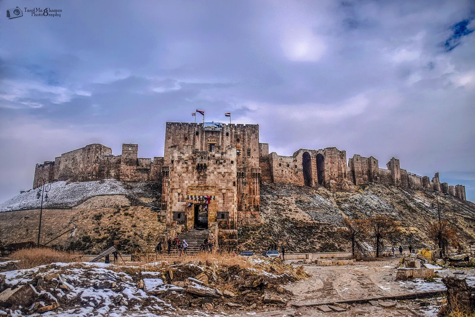
This is a photo of a monument in Syria identified by the ID · Photo: Taref maghames · CC BY-SA 4.0 · Wikimedia Commons · Recorded 2016
Citadel of Aleppo
Local name: قلعة حلب
The Citadel of Aleppo is a fortified medieval palace precinct on a settlement mound in the centre of the old city, and is considered one of the oldest and largest castles in the world. The hill has been used since at least the middle of the 3rd millennium BC, while most of the standing structures are thought to date from the Ayyubid period. As part of the Ancient City of Aleppo it has been a UNESCO World Heritage Site since 1986.
History
A temple of the storm god Hadad, recently excavated and mentioned in cuneiform texts from Ebla and Mari, dates use of the hill to the middle of the 3rd millennium BC; it remained in use until at least the 9th century BC. Medieval Arab historians date the fortified acropolis to the Seleucid ruler Seleucus I, who renamed the city Beroia. Emperor Julian sacrificed a white bull to Zeus on the acropolis in 363, and in the 7th century the townspeople took refuge in the citadel during fighting with the Sasanians.
Muslim armies took Aleppo in 636. The Hamdanid Sayf al-Dawla ruled from the city from 944 and, after the Byzantine sack of 962, the Hamdanids moved their palace into the citadel. Nur ad-Din (r. 1147–1174) fortified it. Its present form is owed chiefly to Saladin's son al-Zahir Ghazi (r. 1193–1215), who strengthened the walls, faced the slope with stone, deepened the moat, spanned it with a bridge and rebuilt the entrance block in 1213.
The Mongols damaged the citadel in 1260 and Timur destroyed it in 1400–1401. From 1415 the Mamluk governor Sayf al-Din Jakam rebuilt it with two advance towers and a palace above the gate. After a restoration under Suleiman I (1521) and heavy damage in the earthquake of 1822, excavation and restoration followed under the French Mandate from the 1930s, and conservation by the Aga Khan Trust for Culture in the 2000s.[1][2][3]
Architecture
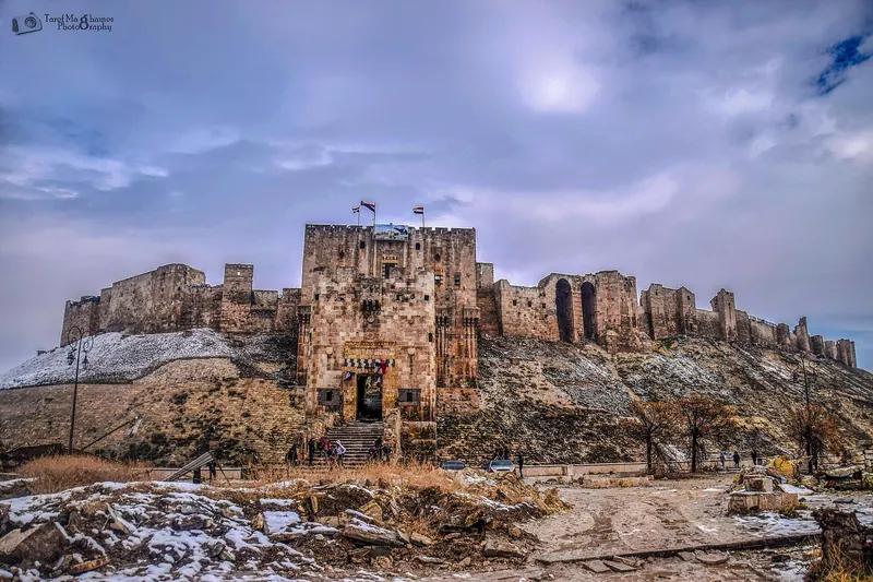
The mound has an elliptical base of 450 by 325 metres and rises about 50 metres; the summit measures 285 by 160 metres. Its slope was once faced entirely with limestone, parts of which survive, and a 12th-century moat 22 metres deep and 30 metres wide surrounds it. The bridge leads into the entrance block, whose route of right-angle turns (five, or more than six in another passage) and three gates with carved figures was designed to slow attackers, aided by machicolations.
Above the entrance block sits the Mamluk Throne Hall, 26.5 by 23.5 metres according to the Arabic Wikipedia; al-Ghawri, the last Mamluk sultan, replaced its flat ceiling with nine domes. Inside are the Ayyubid 'palace of glory' with a muqarnas portal and four-iwan courtyard, a three-part hammam, two mosques converted from Byzantine churches – the Mosque of Abraham and the Great Mosque with its 21-metre minaret – and wells up to 125 metres deep.[1][2][3]
Use and significance
The hill was first a cult site of the storm god, later an acropolis, refuge and fortress. Under the Zengids and Ayyubids the citadel was a seat of rule and a prison for prominent Crusaders: Joscelin II of Edessa died here, and Raynald of Châtillon and King Baldwin II of Jerusalem were held here. In the early 13th century it became a palatial city with residential, religious, military and supply buildings. Under the Ottomans it served as barracks; in 1679 the French consul d'Arvieux counted 1,400 people there, 350 of them Janissaries.
A popular tradition links the hill with Abraham, said to have milked his sheep here; Nur ad-Din gave the Mosque of Abraham a wooden mihrab that was lost during the Mandate. In the 20th century the citadel became an archaeological site and venue, with an amphitheatre added in 1980, and it serves as an emblem of the city. During the civil war the Syrian Army used it as a military base.[1][2][3]
Notable features
Timeline
- mid-3rd millennium BC
The temple of the storm god Hadad on the hill is in use from the 24th century BC.[1][2][3]
- 962
After the Byzantine sack, the Hamdanids move their palace into the citadel.[1][2][3]
- 1193–1215
Rebuilding under al-Zahir Ghazi; the entrance block is rebuilt in 1213.[1][2][3]
- 1400–1401
- 1415
Rebuilding under the Mamluk governor Sayf al-Din Jakam.[1][2][3]
- 1822
A severe earthquake; afterwards only soldiers live in the citadel.[1][2][3]
- 2012–2015
War damage: shelling of the outer gate in 2012, tunnel explosion under the outer wall in 2015.[1][2]
- 2023–2024
Earthquake damage in February 2023; reopening on 17 February 2024 after restoration of the southern advance tower.[1]
Gallery
3D documentation
Loaded from Sketchfab only after you click. Data is then sent to Sketchfab.
The 3D player could not be loaded here.
View 3D model on SketchfabLoading …
Citadel of Aleppo
3D: shehabi77 · Captured 2026-05-20 · Licence: no free licence stated (embedded only) · Open on Sketchfab
Drag to rotate, scroll or pinch to zoom, full screen in the player.
Documented condition
Under restoration · as of 2024
War damage is recorded for August 2012 (outer gate) and July 2015 (tunnel explosion under the outer wall, responsibility disputed); the citadel reopened in early 2018 with repairs under way. After extensive damage in the earthquake of 6 February 2023, it reopened on 17 February 2024 following two restoration phases on the southern advance tower. On 29 November 2024 Hay'at Tahrir al-Sham and other rebel forces captured the citadel.[1][2]
Visiting
Getting here
Documented ride, stay and transport services in Aleppo:
Nearby medical services
Straight-line distance from this place. Data: OpenStreetMap, as of 2026-10-30. Operating status not verified – call before going.
- National HospitalHospital · 0.3 kmDirections
- بناية العطرHospital · 0.5 kmDirections
- قابلة قانونيةHospital · 1.1 kmDirections
- عيادة اسنانHospital · 1.1 kmDirections
- عيادة داخلية اطفالHospital · 1.1 kmDirections
- مشفى الاطفالHospital · 1.2 kmDirections
Sources (19)
- Wikipedia (en): Citadel of Aleppo rev. 1374258197 · CC BY-SA 4.0 · 2026-10-30
- Wikipedia (de): Zitadelle von Aleppo rev. 266667236 · CC BY-SA 4.0 · 2026-10-30
- Wikipedia (ar): قلعة حلب rev. 76938463 · CC BY-SA 4.0 · 2026-10-30
- UNESCO World Heritage Centre: Ancient City of Aleppo · 2026-10-30
- Wikidata · CC0 · 2026-10-30
- Wikipedia (es) · CC BY-SA 4.0 · 2026-10-30
- Wikipedia (fa) · CC BY-SA 4.0 · 2026-10-30
- Wikipedia (fr) · CC BY-SA 4.0 · 2026-10-30
- Wikipedia (it) · CC BY-SA 4.0 · 2026-10-30
- Wikipedia (ja) · CC BY-SA 4.0 · 2026-10-30
- Wikipedia (ko) · CC BY-SA 4.0 · 2026-10-30
- Wikipedia (nl) · CC BY-SA 4.0 · 2026-10-30
- Wikipedia (pl) · CC BY-SA 4.0 · 2026-10-30
- Wikipedia (pt) · CC BY-SA 4.0 · 2026-10-30
- Wikipedia (ru) · CC BY-SA 4.0 · 2026-10-30
- Wikipedia (tr) · CC BY-SA 4.0 · 2026-10-30
- Wikipedia (ur) · CC BY-SA 4.0 · 2026-10-30
- Wikipedia (zh) · CC BY-SA 4.0 · 2026-10-30
- OpenStreetMap · ODbL · 2026-10-30
Abweichungen: römische Übernahme 64 v. Chr. (en/ar) vs. 63 v. Chr. (de); assyrische Herrschaft 8.–7. Jh. (en) vs. 8.–4. Jh. v. Chr. (de/ar); Zahl der Wendungen im Torweg (fünf vs. mehr als sechs); der befestigte Zugang wird einmal az-Zahir Ghazi, einmal den Mamluken im 16. Jh. zugeschrieben. Die Urheberschaft der Explosion vom Juli 2015 ist strittig (Rebellen laut en und SANA, Regierungstruppen laut SOHR); die Wiedereröffnung 2018 (en) und 2024 nach dem Erdbeben stehen nebeneinander.