
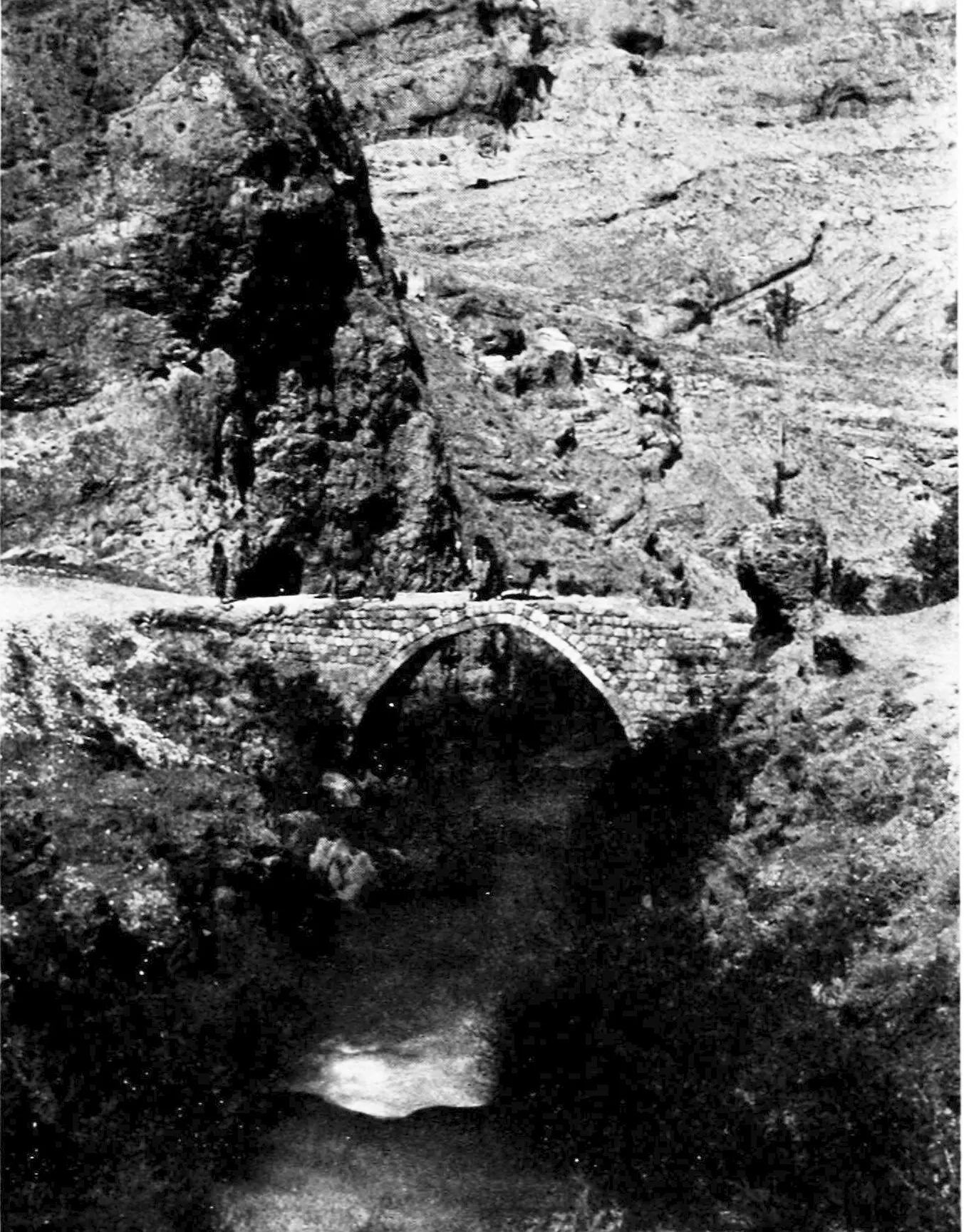
The old bridge over the Barada river · Photo: Unknown author Unknown author · Public domain · Wikimedia Commons · Recorded 1914
Wadi Barada
Local name: وادي بردى
Wadi Barada is the valley of the Barada River north-west of Damascus, directly adjoining the Anti-Lebanon range. According to English Wikipedia it contains 17 villages and towns, and the Ain al-Fijah spring in the valley is a major water source for the capital.
Landscape
Wadi means “valley” in Arabic. The name Barada is thought to derive from barid (“cold”); the ancient Greek name Chrysorrhoas means “streaming with gold”. English Wikipedia describes the valley as mountainous and places it in the Qalamoun district. According to that source the Barada is 84 km long, rises at Zabadani and drains into Lake Otaiba.
Arabic Wikipedia describes the wadi as the course of the river from its source at the lake in the mountains north-west of Damascus, winding between the mountains to al-Rabwa at the edge of the city. The valley consists of a chain of villages from al-Takiyya to al-Hama; Souq Wadi Barada is named as the first village of the chain and one of the most populous. English Wikipedia notes that the river has suffered severe drought in recent decades, mainly due to lower rainfall and a large increase in population.[1][2]
History
The historic railway known as the “summer resorts train” (Qitar al-Masayif) runs through the valley. During the Syrian civil war, rebels captured Ain al-Fijah in February 2012; engineers and technicians at the spring stayed in place. Government forces then imposed a blockade on the villages. On 28 January 2017 the army retook the town, and on the following day it took full control of Wadi Barada.[1][2]
Significance
According to English Wikipedia, water from Ain al-Fijah supplies more than six million people in Damascus and its countryside. Arabic Wikipedia calls the valley the most important summer-resort and excursion area in the Damascus countryside, with long-established resorts such as Dummar, al-Hama, Ain al-Khadra and Ain al-Fijah.
German Wikipedia states that the mausoleum of Abel (Qubbat an-Nabi Habil), venerated by Muslim pilgrims, stands on a mountain in the Barada valley about 25 km north-west of Mount Qasioun.[1][2][3]
Timeline
Gallery
Documented condition
Current condition not documented
Visiting
Getting here
Documented ride, stay and transport services in Rif Dimashq:
Nearby medical services
Straight-line distance from this place. Data: OpenStreetMap, as of 2026-10-30. Operating status not verified – call before going.
- مستوصف اشرفية الواديHospital · 9.3 kmDirections
- مركز الامل الطبيHospital · 9.6 kmDirections
- HospitalHospital · 9.9 kmDirections
- مشفى ضاحية قدسياHospital · 12 kmDirections
- مجمع ضاحية قدسيا الطبيHospital · 12 kmDirections
- مشفى غادة الخاصةHospital · 12 kmDirections
Sources (5)
- Wikipedia (en): Wadi Barada rev. 1333926003 · CC BY-SA 4.0 · 2026-10-30
- Wikipedia (ar): وادي بردى rev. 72339827 · CC BY-SA 4.0 · 2026-10-30
- Wikipedia (de): Dschabal Qāsiyūn rev. 240648603 · CC BY-SA 4.0 · 2026-10-30
- Wikidata · CC0 · 2026-10-30
- Wikipedia (ru) · CC BY-SA 4.0 · 2026-10-30
Quellenlage dünn (en/ar knapp, kein de-Artikel zum Tal; Abel-Mausoleum aus de-Artikel Dschabal Qāsiyūn). Die Dörferliste mit CBS-Zahlen 2004 fehlt im Pack (nur Überschrift) – Einwohnerzahlen nicht übernommen. Lageangaben uneinheitlich: en „im nordwestlichen Teil von Damaskus, im Distrikt Qalamun“, ar Dörferkette von at-Takiyya bis al-Hama; die Etymologie Chrysorrhoas bezieht sich in en auf den Fluss. Ereignisse 2012–2017 nur nach en-Wikipedia; der ar-Verweis auf den „Angriff auf Wadi Barada 2016–17“ ist nur ein Siehe-auch-Link. Kein Zustandsabschnitt.