
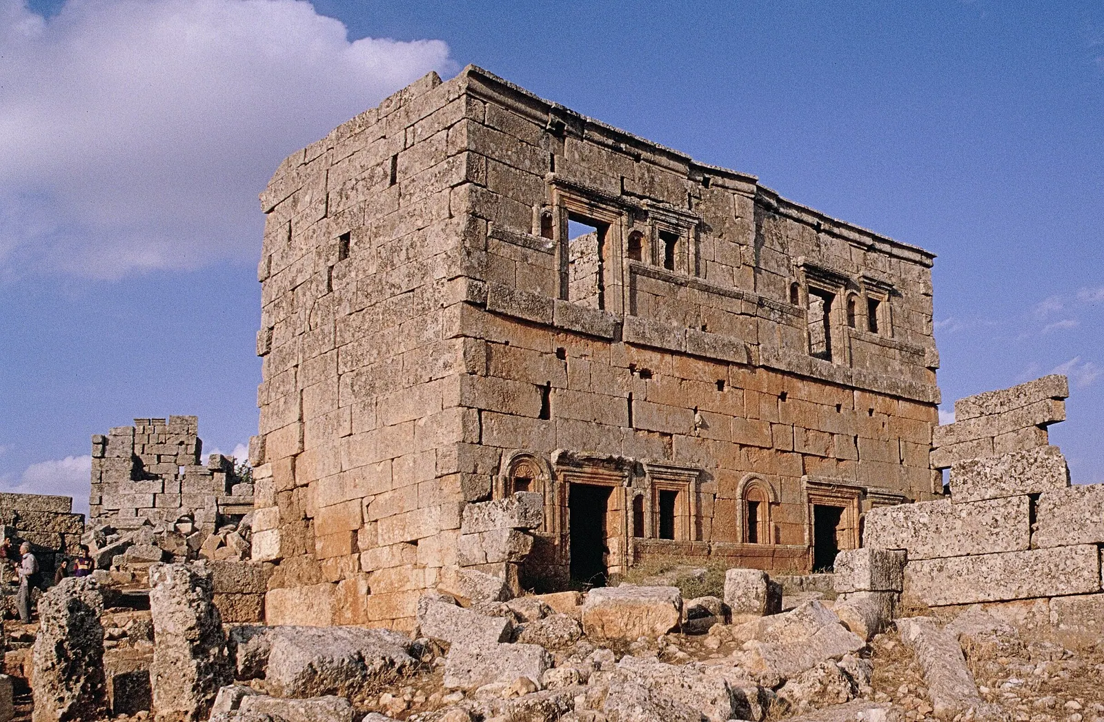
Serjilla · Photo: Haubi|Gerhard Haubold · CC BY-SA 4.0 · Wikimedia Commons · Recorded 1994
Serjilla
Local name: سرجيلا
Serjilla is an early Byzantine settlement in the Limestone Massif of northwestern Syria, in Idlib Governorate at about 700 metres in the Jebel Zawiye (Jebel Riha), close to al-Bara. Its well-preserved houses and communal buildings of the 5th and 6th centuries make it one of the best-known Dead Cities. According to Wikidata (component 1348-004) it forms part of the World Heritage property “Ancient Villages of Northern Syria”.
History
German Wikipedia dates the beginning of the settlement to the mid-4th century and its end to after the 7th century. English Wikipedia gives 473 as the year Serjilla was built; German Wikipedia identifies this as the date (year 784 of the Seleucid era) of a mosaic in the bathhouse. The settlement grew in a natural basin and prospered from grapes and olives; limestone quarrying was also common, sometimes directly beneath buildings. Like most Dead Cities, English Wikipedia says, Serjilla was abandoned in the 7th century after the Arab conquest cut the trade routes between Antioch and Apamea. UNESCO gives the 8th to 10th centuries for the abandonment of the ancient villages as a whole.
Melchior de Vogüé studied the site in the 1860s. Howard Crosby Butler visited with the Princeton expedition in 1899/1900 and again in 1904/05; according to English Wikipedia the floor mosaic the team found had disappeared by the time it returned.[1][2][4]
Architecture
At the centre stand two 5th-century buildings side by side: an andron, a meeting and guest house for men with a two-storey colonnaded portico and capitals of the type Butler called “Syrian”, and a bathhouse. The bath mosaic shows a pomegranate tree; an inscription names Julianos and his wife Donna as donors. The northern part held lounge and changing rooms, the southern part warm and cold baths.
Numerous two-storey houses of limestone blocks, some with porticoes and cornices (such as House no. 18, probably late 5th century), reflect the community's wealth; behind one villa is a sunken building with an olive press. Of the three-aisled basilica, dated by Butler to the mid-5th century, only parts of the apse, the martyrium and the south facade survive.[1][2]
Historical use and significance
Arabic Wikipedia describes the inhabitants as farmers who combined agriculture, livestock and olive-oil production, spoke Syriac, knew Greek and converted from paganism to Christianity. UNESCO values the ancient villages of northern Syria as testimony to rural life in late Antiquity and to the spread of Christianity in village communities. The property was inscribed in 2011 and has been on the List of World Heritage in Danger since 2013; English Wikipedia instead gives 2011 for the danger listing.[1][3][4]
Timeline
- mid-4th c.
Beginning of the settlement according to German Wikipedia.[2]
- 473
Dated mosaic in the bathhouse (year 784 of the Seleucid era).[1][2]
- 1860s
- 1899–1905
Visits by the Princeton expedition under Howard Crosby Butler.[1][2]
- 2011
Inscription of the World Heritage property “Ancient Villages of Northern Syria”.[4]
- 2013
Placed on the List of World Heritage in Danger.[4]
- May 2019
Missile strikes damage the western part.[1]
Gallery
Documented condition
Partly damaged · as of 2019
According to English Wikipedia, refugees lived in the ruins from 2012 to 2015, building ovens and a toilet and causing minor damage. In the western part a military platoon used ruins as quarters and added tin roofs. In May 2019 three missiles struck the western part; a house converted into a guest house in 2011 lost its roof.[1]
Visiting
Getting here
Documented ride, stay and transport services in Idlib:
Nearby medical services
Straight-line distance from this place. Data: OpenStreetMap, as of 2026-10-30. Operating status not verified – call before going.
- مشفى دار الحكمةHospital · 11 kmDirections
- HospitalHospital · 19 kmDirections
- Al-Jisr Hospital (Kidney)Hospital · 20 kmDirections
- Jisr al-Shughur Specialized HospitalHospital · 20 kmDirections
- HospitalHospital · 26 kmDirections
- Al-ZIRA'A hospitalHospital · 29 kmDirections
Sources (11)
- Wikipedia (en): Serjilla rev. 1365340179 · CC BY-SA 4.0 · 2026-10-30
- Wikipedia (de): Serjilla rev. 253770300 · CC BY-SA 4.0 · 2026-10-30
- Wikipedia (ar): سرجيلا rev. 70704678 · CC BY-SA 4.0 · 2026-10-30
- UNESCO World Heritage Centre: Ancient Villages of Northern Syria · 2026-10-30
- Wikidata · CC0 · 2026-10-30
- Wikipedia (es) · CC BY-SA 4.0 · 2026-10-30
- Wikipedia (fr) · CC BY-SA 4.0 · 2026-10-30
- Wikipedia (it) · CC BY-SA 4.0 · 2026-10-30
- Wikipedia (pl) · CC BY-SA 4.0 · 2026-10-30
- Wikipedia (pt) · CC BY-SA 4.0 · 2026-10-30
- OpenStreetMap · ODbL · 2026-10-30
Welterbe-Zugehörigkeit nur über Wikidata belegt (P757 1348-004, P361 Q393841, P1435 Q43113623); die UNESCO-Seite im Paket nennt die einzelnen Bestandteile nicht. QID Q393841 als „Ancient Villages of Northern Syria“ zugeordnet nach dem Paket Q1112125 (basis: Wikidata P361 Q393841). Konflikte: Baujahr 473 (en) ist nach de das Mosaikdatum, Siedlungsbeginn Mitte 4. Jh. (de); Fund des Mosaiks 1899 (en) vs. 1900 (de); Aufgabe 7. Jh. (en) vs. 8.–10. Jh. für die Dörfer insgesamt (UNESCO); Gefährdungsliste 2011 (en) vs. 2013 (UNESCO); Entfernungen (65 km N von Hama / 80 km SW von Aleppo laut en, 35 km S von Idlib laut de; ar-Angabe unklar) nicht übernommen. „Pompeji des Ostens“ und die Bezeichnung der Raketen als „Vakuumraketen russischer Herkunft“ (en) nicht übernommen. Zustandsberichte (SOC) der UNESCO nicht im Paket.