
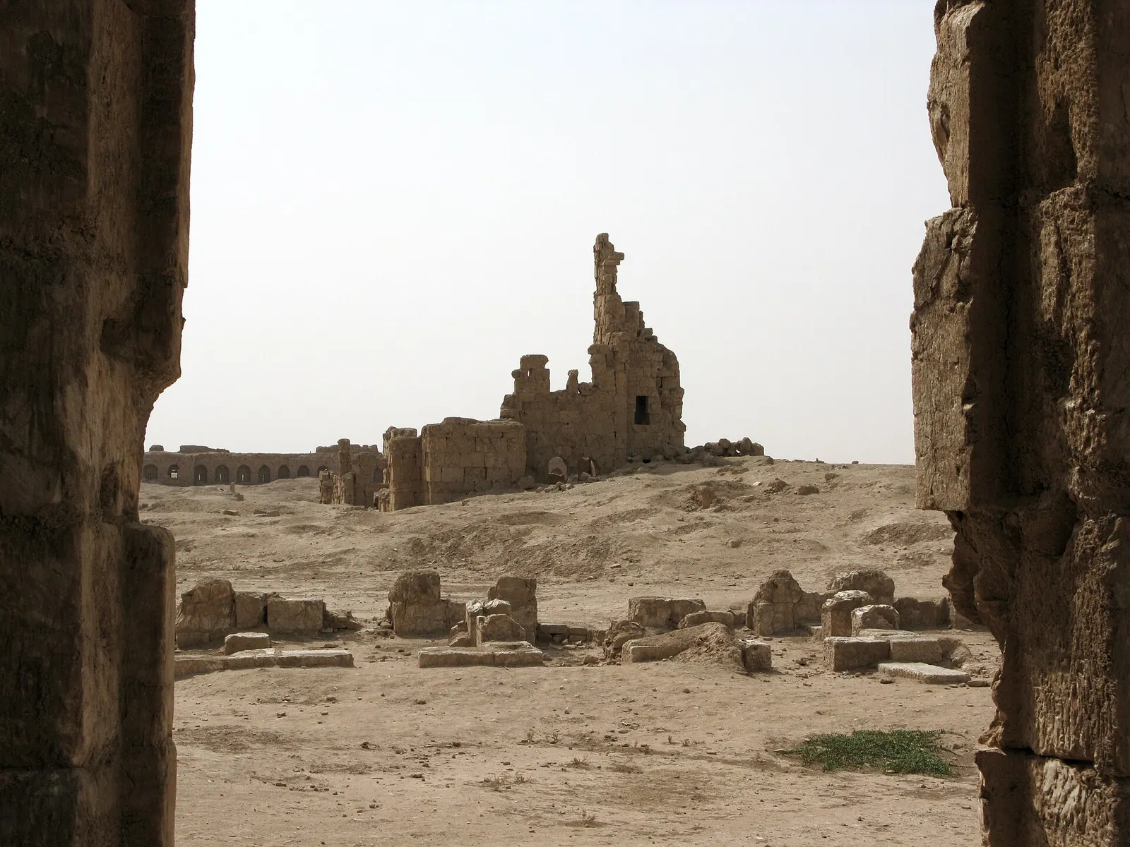
Photo: Vyacheslav Argenberg · CC BY 4.0 · Wikimedia Commons · Recorded 2008
Resafa
Local name: الرصافة
Resafa is a ruined city on the northern edge of the Syrian Desert, southwest of Raqqa and south of the Euphrates. Known in late antiquity as Sergiopolis, it was from the 4th century a major Christian pilgrimage centre at the grave of the martyr Sergius, and in the 8th century the residence of the Umayyad caliph Hisham. Its Justinianic city wall, more than 1,800 metres long, is visible from afar.
History
English Wikipedia traces the site to an Assyrian military camp of the 9th century BC; German Wikipedia mentions an Assyrian administrative place called Raṣappa but considers the link to the biblical Rezeph and to this site unproven, and names early Flavian finds as the earliest, suggesting a foundation as a Roman outpost around AD 70. In Roman times Resafa was a station on the Strata Diocletiana between Sura on the Euphrates and Palmyra.
After the martyrdom of the soldier Sergius (about 312 according to German Wikipedia) his grave became a pilgrimage goal. Resafa was a bishop's see from the early 5th century (English Wikipedia: shortly after 431). Emperor Anastasius I developed the fort into a city and gave it metropolitan rank; the present wall dates from Justinian. In 543 the Sasanian king Khosrau I besieged the city. In the late 6th century Arab allies of the Ghassanids guarded the shrine.
The Byzantines lost the city in 636. Caliph Hisham ibn Abd al-Malik (r. 724–743) made it his favoured residence, built palaces outside the walls and added the Great Mosque to the pilgrimage church. According to German Wikipedia the inhabitants fled from the Mongols to Salamiyya in 1269; Resafa is last mentioned at the end of the 13th century.[1][2][3]
Architecture
The wall, up to 15 metres high and 3 metres thick, built of local gypsum stone, forms an irregular quadrilateral with sides of 350 to 549 metres, a gate on each side, two wall-walks and 50 partly preserved bastions. Within the enclosure of about 21 hectares stand four churches: Basilica A of the late 5th century, according to German Wikipedia the largest surviving wide-arcade basilica in Syria with the largest known bema in the country; Basilica B, begun in 518; a central-plan church (tetraconch) of the early 6th century; and the smaller Basilica C.
With no spring or running water, the city relied on four large underground cisterns; the largest held 15,000 to 16,000 cubic metres according to German Wikipedia. Outside the north gate stands the so-called al-Mundhir building of about 570–580, probably used by the Ghassanids; south of the city lie the barely visible remains of Hisham's palace area.[1][2][3]
Historical use and significance
English Wikipedia describes Resafa as the most important pilgrimage centre of the Byzantine East after Jerusalem, with particular appeal to the local Arabs. German Wikipedia sees the mosque built against the church as a sign of coexistence, allowing Christians and Muslims to venerate the shrine at the same time.[1][2][3]
Timeline
- c. 70
Probable foundation as a Roman outpost (German Wikipedia); English Wikipedia already names an Assyrian camp of the 9th century BC.[1][2]
- c. 312
- 518
Construction of Basilica B begins, according to its building inscription.[2]
- 543
Siege by the Sasanian king Khosrau I.[1]
- 636
- 724–743
Residence of Caliph Hisham ibn Abd al-Malik; palaces and the Great Mosque built.[1][2][3]
- 1269
The inhabitants flee from the Mongols to Salamiyya.[2]
- 1952
Excavations funded by the German Archaeological Institute begin.[2][3]
Gallery
Documented condition
Current condition not documented · as of 2005
According to German Wikipedia, the city interior is a landscape of craters left by illicit digging between 1910 and 1920. Syrian restoration work on the north gate and Basilica A in 1968–1976 took down high wall sections and, according to Thilo Ulbert, damaged walls and floors; in 2004/05 parts of the wall tops were consolidated. During the civil war control changed several times (English Wikipedia: retaken from ISIS on 19 June 2017; Arabic Wikipedia: opposition in 2013, army in June 2016). The sources give no information on war damage.[1][2][3]
Visiting
Getting here
Documented ride, stay and transport services in Raqqa:
Nearby medical services
Straight-line distance from this place. Data: OpenStreetMap, as of 2026-10-30. Operating status not verified – call before going.
No hospital within 30 km in the data.
Sources (15)
- Wikipedia (en): Resafa rev. 1374798501 · CC BY-SA 4.0 · 2026-10-30
- Wikipedia (de): Resafa rev. 264201125 · CC BY-SA 4.0 · 2026-10-30
- Wikipedia (ar): الرصافة (الرقة) rev. 75966783 · CC BY-SA 4.0 · 2026-10-30
- Wikidata · CC0 · 2026-10-30
- Wikipedia (el) · CC BY-SA 4.0 · 2026-10-30
- Wikipedia (es) · CC BY-SA 4.0 · 2026-10-30
- Wikipedia (fa) · CC BY-SA 4.0 · 2026-10-30
- Wikipedia (fr) · CC BY-SA 4.0 · 2026-10-30
- Wikipedia (id) · CC BY-SA 4.0 · 2026-10-30
- Wikipedia (it) · CC BY-SA 4.0 · 2026-10-30
- Wikipedia (nl) · CC BY-SA 4.0 · 2026-10-30
- Wikipedia (pt) · CC BY-SA 4.0 · 2026-10-30
- Wikipedia (ru) · CC BY-SA 4.0 · 2026-10-30
- Wikipedia (ur) · CC BY-SA 4.0 · 2026-10-30
- OpenStreetMap · ODbL · 2026-10-30
Kein UNESCO-Eintrag im Paket. Konflikte: Ursprung assyrisches Lager 9. Jh. v. Chr. (en) vs. unbelegter Bezug, römischer Wachposten um 70 n. Chr. (de); Bischofssitz kurz nach 431 (en) vs. Anfang 5. Jh. (de); Mauermaße über 1600 × 1000 Fuß (en) vs. Umfang über 1800 m, Seiten 350–549 m (de); Ende: Aufgabe im 13. Jh. (en, de) vs. Blüte bis Anfang 10. Jh. und völlige Zerstörung durch die Tataren (ar); Bürgerkrieg: IS, Rückeroberung 19. Juni 2017 (en) vs. Opposition 2013, Armee Juni 2016 (ar). ar-Lageangabe „am Euphrat“ und Entfernungen (ar 75 km zu Qasr al-Hayr al-Sharqi; en-Paket dort 100 km) nicht übernommen. Die ar-Angaben zum Ghassaniden al-Harith II. (Mauerrestaurierung, Kathedrale) und zum geplanten Regionalmuseum im Al-Mundhir-Bau stammen aus einer zitierten Publikation von Bashir Zuhdi (1984) und wurden nicht übernommen. Keine Angaben zu Kriegsschäden in den Quellen.