
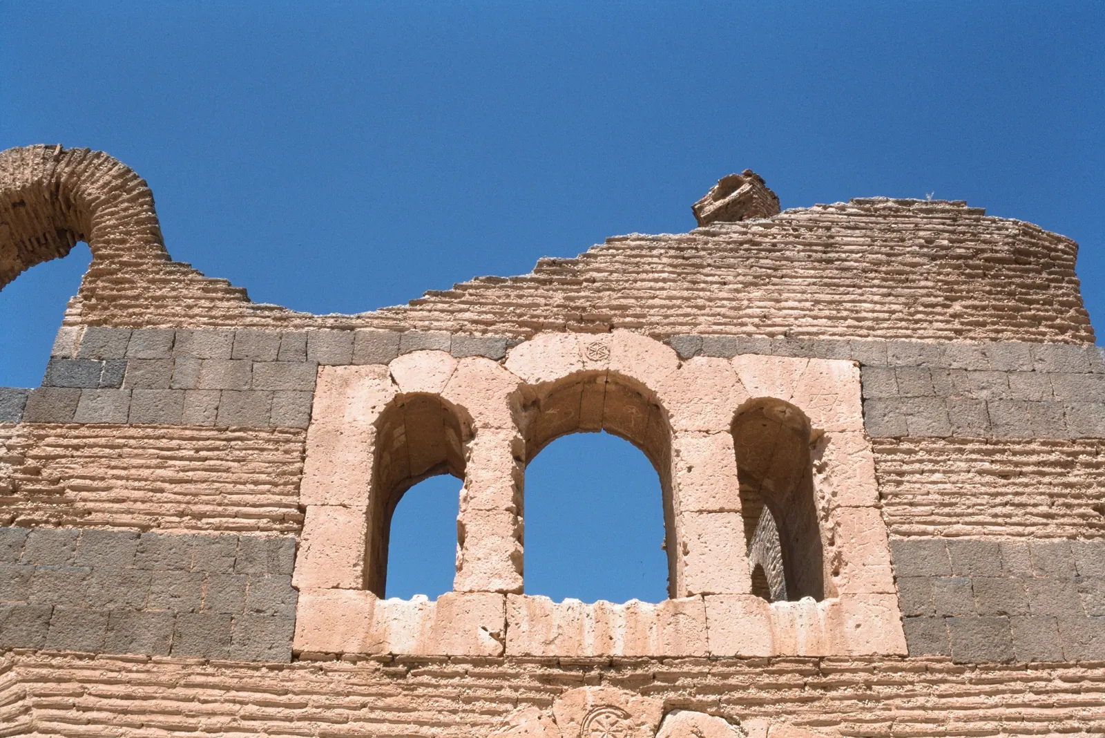
Photo: Frank Kidner · CC BY-SA 4.0 · Wikimedia Commons · Recorded 1996
Qasr ibn Wardan
Local name: قصر ابن وردان
Qasr ibn Wardan is a 6th-century Byzantine complex of palace, church and barracks in the Syrian Desert, about 60 km north-east of Hama. The ruins lie west of a road, with a hamlet of the same name to the east, which had 467 inhabitants in the 2004 census. According to the English Wikipedia, its style was imported directly from Constantinople and is found nowhere else in present-day Syria.
History
Emperor Justinian I (r. 527–565) had the complex built in the mid-6th century as part of a defensive line against the Sasanian Empire, together with Resafa and Halabiye. The Arabic Wikipedia mentions the dates 562–564 on the upper windows of the church and palace, but elsewhere gives the 5th century as the time of construction. According to the English Wikipedia, the unusual style was probably chosen to impress local Bedouin tribes and consolidate control over them.
According to the Arabic Wikipedia, the name is Arabic and later than the building: it refers to an influential Bedouin figure known as Ibn Wardan, who about three centuries ago used the palace as a stopover and probably belonged to the Anaza tribe. On 8 February 2018 the Syrian Arab Army recaptured the village and site from ISIS.[1][2]
Architecture
The palace shows alternating bands of black basalt and yellow brick (ablaq in Arabic). Basalt was brought from areas far to the north or south; the marble columns and capitals are thought to come from Apamea. The palace, probably also the local governor's residence, covers about 2,000 m² around a square courtyard 25.5 m across according to the Arabic Wikipedia. Its best-preserved part is the southern façade; there are remains of stables to the north and a small bath to the east. The function of each room was indicated by a carved stone.
The church west of the palace is square, with a nave and two aisles, and was once topped by a large dome of which only a pendentive remains; it is an example of early Byzantine dome construction. Upper galleries for women ran along three sides, of which the north and south walls survive; the fourth side ends in a half-domed apse. Nothing remains today of the barracks south of the palace.[1][2]
Timeline
Gallery
Documented condition
Current condition not documented · as of 2018
The sources contain no dated condition statement. The latest documented event is the military recapture on 8 February 2018; the sources say nothing about possible war damage.[1]
Visiting
Getting here
Documented ride, stay and transport services in Hama:
Nearby medical services
Straight-line distance from this place. Data: OpenStreetMap, as of 2026-10-30. Operating status not verified – call before going.
- Aziz Freij PharmacyHospital · 29 kmDirections
- مركز عقارب الصحيHospital · 30 kmDirections
Sources (11)
- Wikipedia (en): Qasr Ibn Wardan rev. 1378970530 · CC BY-SA 4.0 · 2026-10-30
- Wikipedia (ar): قصر ابن وردان rev. 70738788 · CC BY-SA 4.0 · 2026-10-30
- Wikidata · CC0 · 2026-10-30
- Wikipedia (el) · CC BY-SA 4.0 · 2026-10-30
- Wikipedia (es) · CC BY-SA 4.0 · 2026-10-30
- Wikipedia (fa) · CC BY-SA 4.0 · 2026-10-30
- Wikipedia (fr) · CC BY-SA 4.0 · 2026-10-30
- Wikipedia (it) · CC BY-SA 4.0 · 2026-10-30
- Wikipedia (pl) · CC BY-SA 4.0 · 2026-10-30
- Wikipedia (ru) · CC BY-SA 4.0 · 2026-10-30
- OpenStreetMap · ODbL · 2026-10-30
Keine deutsche Wikipedia und kein deutsches Wikidata-Label; der Name wird unübersetzt verwendet. Bauzeit: Mitte 6. Jh. (en) und Inschriften 562–564 (ar) vs. „5. Jahrhundert“ im ar-Einleitungssatz (vermutlich Fehler). Lage: 60 km nordöstlich (en) vs. 60 km östlich (ar) von Hama. Palastform: ar nennt ihn sowohl „kreuzförmig“ als auch quadratisch – nicht übernommen. Der ar-Artikel ist sprachlich teils fehlerhaft (u. a. ein unverständlicher Satz im Architekturabschnitt) und vergleicht den Bau mit dem Azim-Palast; diese Vergleiche wurden nicht übernommen. Ein Verweis auf Kamel Schehade und seine Rolle bei der Restaurierung ist nur ein „Siehe auch“-Eintrag ohne Inhalt; Restaurierungsgeschichte offen. Kriegsschäden nicht dokumentiert. Einzige Fachliteratur: Ross Burns, Monuments of Syria (in en zitiert, nicht eingesehen).