
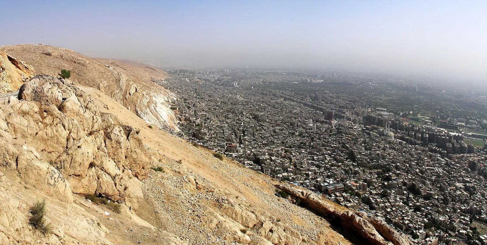
The city of Damascus seen from Mount Qasioun, Syria · Photo: JYB Devot · CC BY-SA 4.0 · Wikimedia Commons · Recorded 2010
Mount Qasioun
Local name: جبل قاسيون
Mount Qasioun is the mountain of about 1,150 m that overlooks Damascus, offering a view over the whole city. Districts such as al-Muhajirin and Rukn al-Din lie at its foot and on its slopes, and caves on its flanks feature in religious traditions.
Landscape
English Wikipedia gives the highest point as 1,151 m, German Wikipedia 1,150 m and Arabic Wikipedia “more than 1,150 m”. Arabic Wikipedia describes the mountain as an extension of the western Syrian ranges. The name may mean “hard and dry” in Syriac, matching the bare rocky mountain without grass or water.
The endemic Iris damascena grows at high elevation on the steep eastern slopes. It has no formal protection and is classified as critically endangered; part of its habitat, however, lies in a military area near the Republican Guard base that is closed to civilians, and the steep terrain prevents construction.[1][3]
History
An older description quoted by Arabic Wikipedia mentions a cemetery of the pious on its slope and a large quarter with tombs, hospices, schools, two Friday mosques, a hospital and a large market, first settled by people from Jerusalem who left before Saladin's conquest. According to the same source, urban development reached the mountain in the 19th and 20th centuries.
From the start of the civil war the mountain was heavily fortified by government forces; the army dug a network of tunnels to garrison the Republican Guard and used it for sniper and artillery positions. Public access was restricted until the end of Assad rule in December 2024.[1][2][3]
Significance
Relay stations for broadcasting and telecommunications stand on the summit, and restaurants and cafés offer views over the city. The Unknown Soldier monument stands on the south-western slope; Arabic Wikipedia also mentions two historic domes, the Qubbat al-Sayyar observatory on Jabal al-Jank and the now-destroyed Qubbat al-Nasr.
The best-known site is the Cave of Blood (Maghārat al-Dam): legend holds that Adam lived there, and medieval Arab histories name it as the place where Cain killed Abel. In times of drought the rulers of Damascus climbed to it to pray for rain; a small mosque over the cave contains the prayer niches of the forty saints (Abdāl). Further down lay the Cave of Hunger, now hidden by houses, and on another flank a cave claimed as that of the Seven Sleepers – a claim the sources call doubtful.[1][2][3]
Timeline
Gallery
Documented condition
Current condition not documented
Visiting
Getting here
Documented ride, stay and transport services in Damascus:
Nearby medical services
Straight-line distance from this place. Data: OpenStreetMap, as of 2026-10-30. Operating status not verified – call before going.
- مستوصف جمعية الأعمال الخيريةHospital · 1.7 kmCallDirections
- مشفى هشام سنانHospital · 1.8 kmDirections
- Ibn Nafees HospitalHospital · 1.9 kmCallDirections
- مستشفى العيون الجراحيHospital · 1.9 kmDirections
- مشفى المنار الدوليHospital · 1.9 kmDirections
- Ummayad HospitalHospital · 1.9 kmDirections
Sources (15)
- Wikipedia (en): Mount Qasioun rev. 1369581345 · CC BY-SA 4.0 · 2026-10-30
- Wikipedia (de): Dschabal Qāsiyūn rev. 240648603 · CC BY-SA 4.0 · 2026-10-30
- Wikipedia (ar): جبل قاسيون rev. 77061726 · CC BY-SA 4.0 · 2026-10-30
- Wikidata · CC0 · 2026-10-30
- Wikipedia (es) · CC BY-SA 4.0 · 2026-10-30
- Wikipedia (fa) · CC BY-SA 4.0 · 2026-10-30
- Wikipedia (fr) · CC BY-SA 4.0 · 2026-10-30
- Wikipedia (hi) · CC BY-SA 4.0 · 2026-10-30
- Wikipedia (id) · CC BY-SA 4.0 · 2026-10-30
- Wikipedia (ja) · CC BY-SA 4.0 · 2026-10-30
- Wikipedia (ru) · CC BY-SA 4.0 · 2026-10-30
- Wikipedia (tr) · CC BY-SA 4.0 · 2026-10-30
- Wikipedia (ur) · CC BY-SA 4.0 · 2026-10-30
- Wikipedia (zh) · CC BY-SA 4.0 · 2026-10-30
- OpenStreetMap · ODbL · 2026-10-30
Höhe 1151 m (en) / 1150 m (de) / >1150 m (ar). Beginn der militärischen Nutzung „vom Beginn des Bürgerkriegs an“ (en) – Jahr 2011 abgeleitet, nicht wörtlich belegt. Nicht übernommen: Die de-Wikipedia schreibt, die UN-Untersuchung der Ghuta-Giftgasangriffe vom August 2013 lege einen Abschuss von diesem Berg nahe; dies sollte vor einer Aufnahme am UN-Bericht selbst geprüft werden. Ebenfalls nicht übernommen: Behauptung, Tunnel führten zum Präsidentenpalast („said to“). Das historische Zitat in ar stammt aus einem nicht genannten älteren Werk; Datierung offen. Der Zustand der Qubbat an-Nasr („heute zerstört“) ist undatiert. Kain-Abel-Legende: de nennt das Abel-Mausoleum im Barada-Tal (in Q12250549 verwendet).