
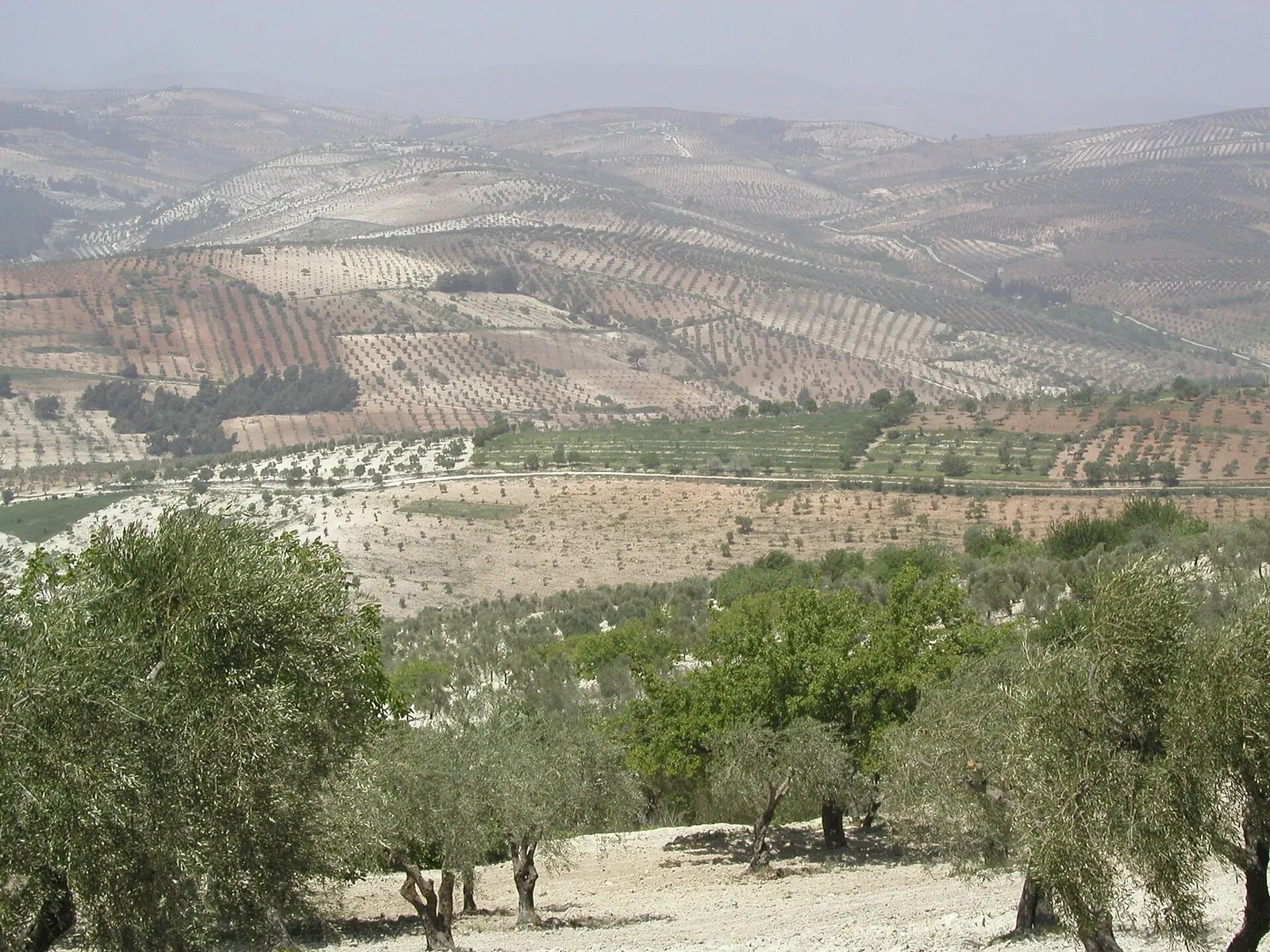
Olive orchards in Syria – olive trees in the hills of Afrin District, Aleppo Governorate · Photo: عمرو بن كلثوم · CC BY-SA 3.0 · Wikimedia Commons · Recorded 2005
Kurd Mountain
Local name: جبل الأكراد
Kurd Mountain or Kurd Dagh is a highland region in north-western Syria and south-eastern Turkey, extending from Aleppo Governorate into Kilis Province. Its main town is Afrin, and the area is known for olive growing. It should not be confused with Jabal al-Akrad in Latakia Governorate.
Landscape
According to English Wikipedia the upland is part of the Limestone Massif of north-western Syria, continuing the highlands of the western Aintab plateau southwards; German and Arabic Wikipedia assign it to the Taurus system. The Afrin valley encloses it to the east and south, separating it from the Azaz plain and Mount Simeon; to the west the valley of the Aswad River separates it from the Amanus. Elevations range from 700 to 1,269 m. Arabic Wikipedia gives a width of 55 km and a length of 75 km, about 3,850 km² or some 2% of Syria's area.
The climate is Mediterranean, with hot summers and cold, humid winters; Arabic Wikipedia gives mean annual rainfall in the Afrin area as 546.6 mm. The region lies at the north-western edge of the Arabian Plate; on 13 August 1822 an earthquake of about magnitude 7.3 was centred on Kurd Dagh, followed by another in 1872 on the southern edge of the Afrin area.[1][2][3]
History
According to the Sharafnama, Kurdish emirs of Kilis ruled the area. It was part of the Ottoman Empire until the First World War and enjoyed a degree of autonomy until the mid-19th century. The French Mandate borders divided it: the north went to Turkey, the south remained under French administration. The kaza of Kurd Dagh in the State of Aleppo had 21,823 inhabitants in 1922; according to German Wikipedia the area became part of independent Syria in 1946. In the 1930s, according to English Wikipedia, Kurdish Alevis who had fled Dersim settled in Mabeta.
The name Kurd Dagh is the Ottoman rendering of Jabal al-Akrad. According to the sources, the Syrian part was later called Afrin, renamed “Jabal al-Uruba” by decree 15801 in 1977 and afterwards “Jabal Halab” (Mount Aleppo); the Turkish part is officially called Kurt Dağı (“Wolf Mountain”).[1][2][3]
Significance
The population is predominantly Kurdish; most are Sunni Muslims of the Hanafi school, and there is also a Yazidi presence. The main crop is the olive, with more than 13 million trees according to Arabic Wikipedia, alongside cereals, vegetables, cotton and fruit. Traditional trades include olive-oil and soap making and hand-knotted carpets; English Wikipedia also mentions charcoal production. The forests, mostly pine and cypress, are described as the largest in Aleppo Governorate.[1][2][3]
Timeline
- 1822
Earthquake of about magnitude 7.3 centred on Kurd Dagh (13 August).[3]
- 1922
State of Aleppo census: 21,823 inhabitants in the kaza of Kurd Dagh.[1][3]
- 1932
French estimate: about 43,000 inhabitants in the kaza of Kurd Dagh.[3]
- 1946
The area becomes part of independent Syria (per German Wikipedia).[2]
- 1977
Documented condition
Current condition not documented
Visiting
Getting here
Documented ride, stay and transport services in Aleppo:
Nearby medical services
Straight-line distance from this place. Data: OpenStreetMap, as of 2026-10-30. Operating status not verified – call before going.
- مسجد شيخ محمدليHospital · 14 kmDirections
- Afrin HospitalHospital · 17 kmDirections
- HospitalHospital · 20 kmDirections
- Azez National HospıtalHospital · 25 kmDirections
- االمشفى الأهليHospital · 26 kmDirections
- مشفى التوليدHospital · 26 kmDirections
Sources (8)
- Wikipedia (en): Kurd Mountain rev. 1369424275 · CC BY-SA 4.0 · 2026-10-30
- Wikipedia (de): Kurd Dagh rev. 268478862 · CC BY-SA 4.0 · 2026-10-30
- Wikipedia (ar): جبل الأكراد rev. 75057975 · CC BY-SA 4.0 · 2026-10-30
- Wikidata · CC0 · 2026-10-30
- Wikipedia (es) · CC BY-SA 4.0 · 2026-10-30
- Wikipedia (fa) · CC BY-SA 4.0 · 2026-10-30
- Wikipedia (pl) · CC BY-SA 4.0 · 2026-10-30
- Wikipedia (tr) · CC BY-SA 4.0 · 2026-10-30
Abgrenzung zu Dschabal al-Akrad (Latakia) laut en beachtet. Zuordnung: en Kalksteinmassiv/Aintab-Plateau vs. de/ar Taurus – beide genannt. Ausdehnung: ar 55 × 75 km und 3850 km² (de ebenfalls 3850 km²); ar nennt an anderer Stelle ca. 100 km Länge und 25–45 km Breite der Höhenzüge – nicht übernommen. Höchster Gipfel: de „Greh Mahsn“, ar „der Große Berg“ (1269 m) – Name nicht übernommen. Umbenennungen nach en/ar; die Bewertung der Namenspolitik (en: Verbot kurdischer Namen; de: „verballhornt“) wurde neutral auf die dokumentierten Fakten reduziert. Ereignisse nach 2011 sind in den Quellen nur angedeutet (Sufi-Gemeinde „vor dem Bürgerkrieg“) und nicht dargestellt. Leere Zensusabschnitte 1994/2001/2004–05 im ar-Pack.