
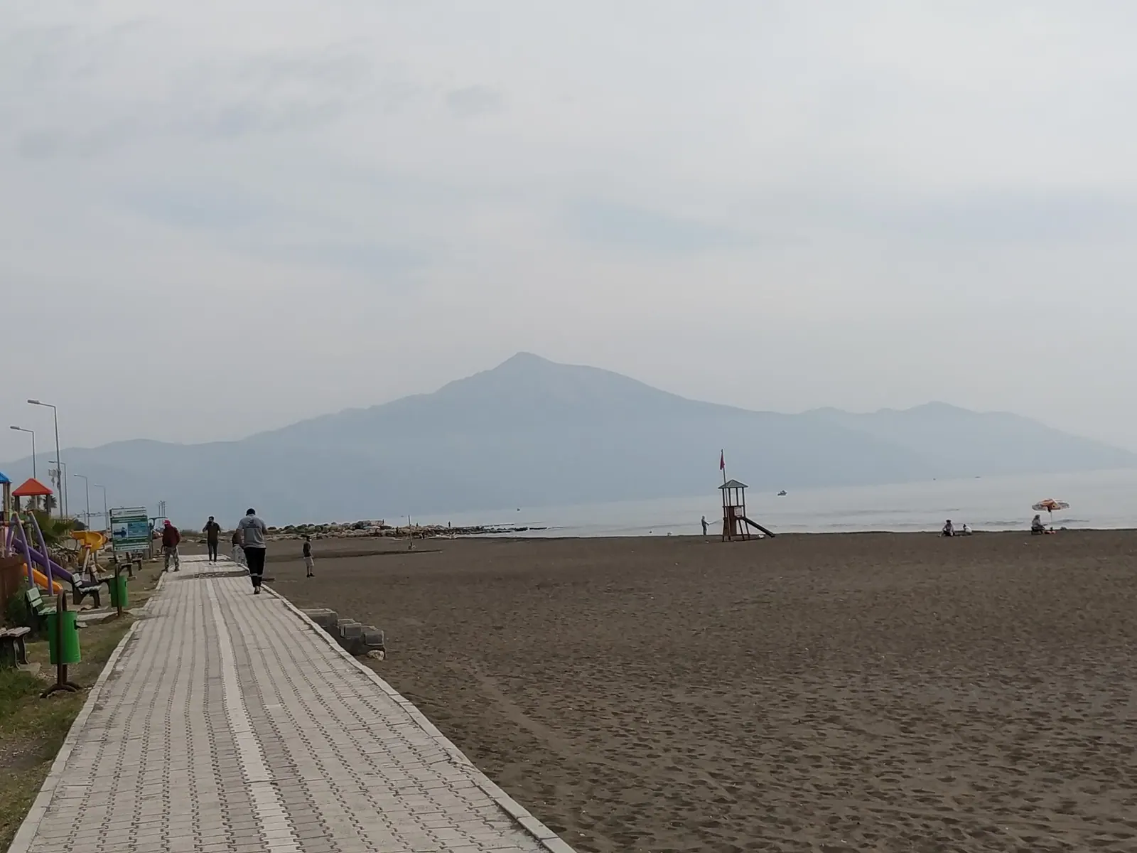
Distant view of the Kel Mountain · Photo: NowhereLady · CC BY-SA 4.0 · Wikimedia Commons · Recorded 2020
Jebel Aqra
Local name: الجبل الأقرع
Jebel Aqra (Turkish Kel Dağı, “bald mountain”), known in antiquity as Kasios or Mount Casius, is a limestone mountain of 1,736 m on the Syrian–Turkish border near the mouth of the Orontes. As Hazzi, Sapanu and Zaphon it was a sacred mountain of storm gods for millennia.
Landscape and location
English and German Wikipedia place the mountain on the Syrian–Turkish border. According to German Wikipedia the Syrian part lies within the area of the Armenian-influenced town of Kessab in Latakia Governorate and the Turkish part in Yayladağı district of Hatay Province. Arabic Wikipedia places it in the far south-west of the Liwa of Iskenderun, which it describes as now a Turkish province and as having been Syrian territory until 1939.
The mountain rises from a narrow coastal plain, serves as a landmark for mariners and gathers thunderstorms. In an area known for dense forest it is treeless because of its difficult terrain. Ugarit lies 30 km to the south according to English Wikipedia, about 40 km according to German Wikipedia.[1][2][3]
History
The Hurrians and Hittites called the mountain Hazzi and regarded it as the home of the storm god Teshub; the Hittites invoked it as a divine guarantor in treaties. At Ugarit the peak of Sapanu was held to house the palace of the storm god Baal; in 677 BCE a king of Tyre called on Baal Zaphon as a witness in a treaty with Assyria. In the Hebrew Bible the mountain appears as Zaphon, and the Hebrew word for “north” derives from its name.
The Greeks rendered the name as Kasios, and the cult passed to Zeus Kasios, worshipped there into the 4th century according to German Wikipedia. Seleucus I consulted Zeus here on founding Seleucia. Trajan survived a major earthquake at Antioch in 114/115 CE; Hadrian climbed the mountain in 130 CE and Julian in spring 363. Christian hermits followed: Barlaam founded a monastery on the eastern slopes, and Simeon Stylites the Younger stood for forty years on a pillar near its northern flank until his death in 592.[1][2][3]
Significance
The cult site is a mound of ash and debris 55 m wide and 7.9 m deep, of which only the top 1.8 m have been excavated. Excavation reached the Hellenistic strata before it was halted because the site lies in a Turkish military zone. According to English Wikipedia, the remains are presumed destroyed since a Turkish military base was built on the summit in 2012.[1]
Timeline
- 677 BCE
A king of Tyre invokes Baal Zaphon as witness to a treaty with Assyria.[1]
- 114/115
Trajan survives the Antioch earthquake; commemorative coins show the shrine of Zeus Kasios.[1]
- 130
- 363
Emperor Julian climbs the mountain and visits the sanctuary.[1][2]
- 592
Death of Simeon Stylites the Younger after forty years on a pillar on the northern flank.[1]
- 2012
Turkish military base built on the summit; remains of the cult site presumed destroyed.[1]
Gallery
Documented condition
Current condition not documented · as of 2012
Visiting
Getting here
Documented ride, stay and transport services in Latakia:
Nearby medical services
Straight-line distance from this place. Data: OpenStreetMap, as of 2026-10-30. Operating status not verified – call before going.
No hospital within 30 km in the data.
Sources (12)
- Wikipedia (en): Jebel Aqra rev. 1382322743 · CC BY-SA 4.0 · 2026-10-30
- Wikipedia (de): Keldağ rev. 258197283 · CC BY-SA 4.0 · 2026-10-30
- Wikipedia (ar): الجبل الأقرع rev. 67975174 · CC BY-SA 4.0 · 2026-10-30
- Wikidata · CC0 · 2026-10-30
- Wikipedia (fa) · CC BY-SA 4.0 · 2026-10-30
- Wikipedia (fr) · CC BY-SA 4.0 · 2026-10-30
- Wikipedia (it) · CC BY-SA 4.0 · 2026-10-30
- Wikipedia (nl) · CC BY-SA 4.0 · 2026-10-30
- Wikipedia (pl) · CC BY-SA 4.0 · 2026-10-30
- Wikipedia (pt) · CC BY-SA 4.0 · 2026-10-30
- Wikipedia (ru) · CC BY-SA 4.0 · 2026-10-30
- Wikipedia (tr) · CC BY-SA 4.0 · 2026-10-30
Grenzlage wie in den Quellen wiedergegeben: en/de „an der syrisch-türkischen Grenze“ (de: syrischer Teil Kessab/Latakia, türkischer Teil Yayladağı/Hatay); ar: im Südwesten des Liwa Iskenderun, „bis 1939 syrisch“ – nur zugeschrieben, keine eigene Bewertung. Namen: Wikidata-Label en „Hazzi“, en-Wikipedia-Titel „Jebel Aqra“ (verwendet); de-Label/Titel „Keldağ“. Widersprüche: Entfernung nach Ugarit 30 km (en) vs. ca. 40 km (de); Hadrian: en Besteigung bei Nacht, Blitz traf Opfertier; de nach Historia Augusta Sturm verhinderte Sonnenaufgangsbeobachtung (nur die Besteigung 130 übernommen). Höhe 1736 m nach de/ar (en ohne Angabe). Der „südliche Kasion“ am Sirbonischen See (de) ist ein anderer Berg und nicht Teil dieses Eintrags. Zustand der Kultstätte nur als Vermutung („presumed“) belegt.