
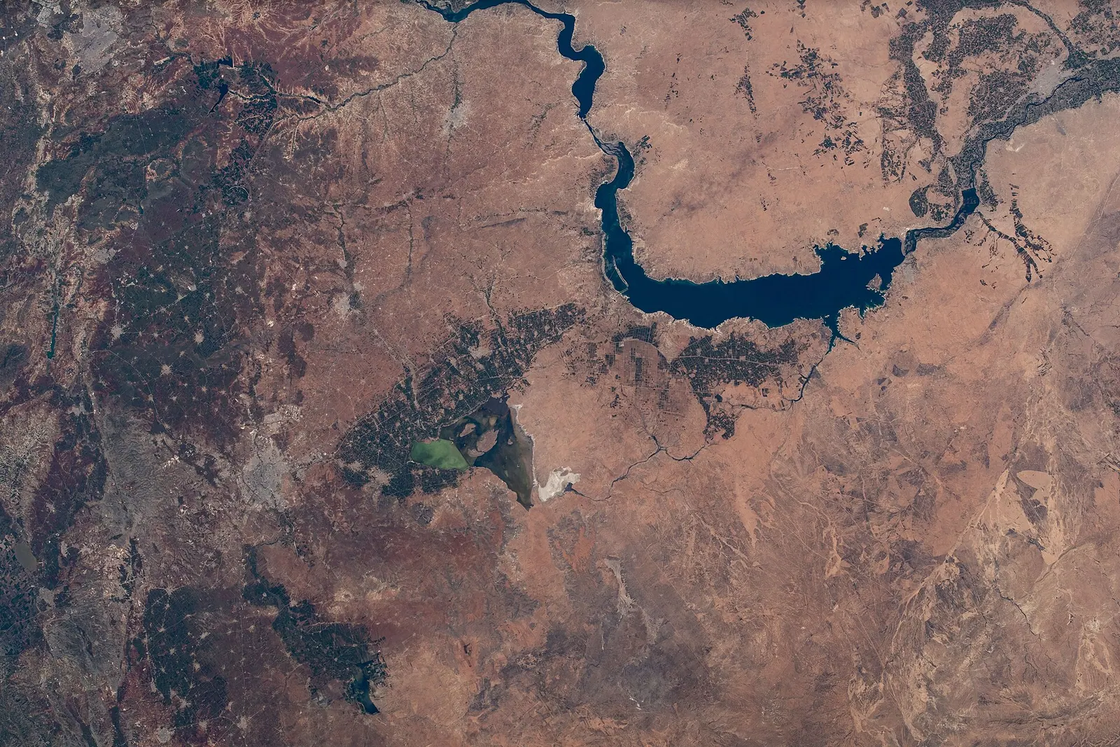
The Euphrates flows through Lake Assad in Syria – photographed from the International Space Station orbiting 263 miles above · Photo: NASA · Public domain · Wikimedia Commons · Recorded 2021
Euphrates Lake
Local name: بحيرة الفرات
Euphrates Lake, also called Lake Tabqa and formerly Lake Assad, is a reservoir on the Euphrates in Raqqa Governorate. It was created in 1974 when the Euphrates (Tabqa) Dam was completed and is Syria's largest lake. It serves irrigation, drinking-water supply for Aleppo and a fishing industry.
Landscape
English Wikipedia gives a maximum capacity of 11.7 km³ but states two different maximum surface areas (525 km² and 610 km²); the actual capacity is much lower at 9.6 km³, with a surface area of 447 km². Arabic Wikipedia gives a maximum capacity of 14.1 km³.
The western shore has developed into an important marshland; on the south-eastern shore, areas have been reforested with evergreen trees including Aleppo pine and Euphrates poplar. The lake is an important wintering site for migratory birds; before 2004 the government protected parts of the shore from hunters by downgrading access roads. The island of Jazirat al-Thawra is a nature reserve.[1][3]
History
The first plans for a dam on the Syrian Euphrates date to 1927. In 1957 Syria agreed technical and financial aid with the Soviet Union, followed in 1960 by a financing agreement with West Germany and in 1965 by another with the Soviet Union. The dam was built between 1968 and 1973; flooding of the reservoir began in 1974 by reducing the river's flow. The project was completed under President Hafez al-Assad as part of his modernisation policies and agricultural reforms. In 1975 Iraq complained that the flow had fallen below an acceptable level and threatened to bomb the dam; mediation by Saudi Arabia and the Soviet Union settled the dispute.
Before the flooding, an international programme of rescue excavations ran from 1963 to 1974 at sites ranging from the Late Natufian to the Ottoman period, including Tell Abu Hureyra, Emar, Habuba Kabira, Mureybet, Tell es-Sweyhat, Tell Fray and Dibsi Faraj. Qal'at Ja'bar, whose hilltop became an island, received a protective glacis, and two minarets at Mureybet and Meskene were moved out of the flood zone.
During the civil war the water level dropped significantly, possibly because the power station drew more water than the Euphrates supplied. In May 2026, according to English Wikipedia, the level reached 97%, a height not seen for decades, causing flooding downstream in Raqqa and Deir ez-Zor governorates.[1][2]
Significance
The scheme was meant to irrigate 640,000 hectares on both banks. Gypsum-rich soils, salinisation, collapsing canals and farmers' reluctance to resettle meant that only 60,000 hectares were irrigated in 1984; by 2000 the figure had risen to 124,000 hectares, 19% of the plan. A pipeline supplies Aleppo with 80 million m³ of drinking water a year from the lake.[1][2]
Timeline
- 1927
- 1957–1965
Financing agreements with the Soviet Union (1957, 1965) and West Germany (1960).[1][2]
- 1963–1974
International archaeological rescue excavations in the future reservoir area.[1]
- 1968–1973
- 1974
- 1975
Dispute with Iraq over the river's flow, settled through Saudi and Soviet mediation.[1][2]
- 2000
124,000 hectares irrigated – 19% of the planned area.[1]
- May 2026
Water level reaches 97%; flooding downstream.[1]
Gallery
Documented condition
Current condition not documented
Visiting
Getting here
Documented ride, stay and transport services in Raqqa:
Nearby medical services
Straight-line distance from this place. Data: OpenStreetMap, as of 2026-10-30. Operating status not verified – call before going.
- مركز دبسي فرج الصحيHospital · 14 kmDirections
Sources (16)
- Wikipedia (en): Euphrates Lake rev. 1365991913 · CC BY-SA 4.0 · 2026-10-30
- Wikipedia (ar): بحيرة الفرات rev. 74858630 · CC BY-SA 4.0 · 2026-10-30
- Wikidata: Q979315 (Euphrates Lake) · CC0 1.0 · 2026-10-30
- Wikipedia (es) · CC BY-SA 4.0 · 2026-10-30
- Wikipedia (fa) · CC BY-SA 4.0 · 2026-10-30
- Wikipedia (fr) · CC BY-SA 4.0 · 2026-10-30
- Wikipedia (id) · CC BY-SA 4.0 · 2026-10-30
- Wikipedia (it) · CC BY-SA 4.0 · 2026-10-30
- Wikipedia (ko) · CC BY-SA 4.0 · 2026-10-30
- Wikipedia (nl) · CC BY-SA 4.0 · 2026-10-30
- Wikipedia (pl) · CC BY-SA 4.0 · 2026-10-30
- Wikipedia (pt) · CC BY-SA 4.0 · 2026-10-30
- Wikipedia (ru) · CC BY-SA 4.0 · 2026-10-30
- Wikipedia (sv) · CC BY-SA 4.0 · 2026-10-30
- Wikipedia (tr) · CC BY-SA 4.0 · 2026-10-30
- Wikipedia (zh) · CC BY-SA 4.0 · 2026-10-30
Zahlenkonflikte: maximale Fläche 525 km² (en-Einleitung) vs. 610 km² (en-Abschnitt Characteristics); maximale Kapazität 11,7 km³ (en) vs. 14,1 km³ (ar, mit fehlerhafter Umrechnung „2,8 mi³“). Dammname wechselt zwischen Euphrat-Damm und Tabqa-Damm (gleiches Bauwerk laut Quellen). Der Pegelstand Mai 2026 stammt nur aus en-Wikipedia. Kein de-Artikel im Pack; deutscher Name nach Wikidata-Label. Als „region“ (See als Landschaft) eingeordnet; der Damm selbst wäre ein eigener Infrastruktur-Eintrag. Das Datum der Umbenennung von „Assad-See“ nennt keine Quelle.